Results 1 to 2 of 2

Thread: Require Assistance with Climate/Altitude/Future Map

  1. #1
    Guild Apprentice
    Join Date
    Jul 2007
    Posts
    44

    Question Require Assistance with Climate/Altitude/Future Map

    Hello all, I come here from the CBG. I've been working on my setting for quite some time, and now that D&D is undergoing the shift from 3E to 4E, I figured this would be a great time to get the non-rules elements of my setting finalized. Rather than work on the world as a whole, I want to focus on a single region.

    Right now, I'm trying to make a map for one region of my world. My setting is Earth in the future, after a cataclysm set everything back. I'm not sure exactly how far into the future I want it to be; originally, I was going to set it FAR in the future (100 Million Years or so), so that I could play with plate tectonics a bit, but now I'm thinking that a more reasonable 5 Million is in order (which will let me use modern maps a bit more). This will allow me to use modern maps with little alteration.

    With that out of the way, the region I'll be using is China/Southeast Asia. I have found several maps, but unfortunately they are all of a different projection, making it difficult to transfer material from one to another. I have photoshop, and have been trying to make the transfer that way, but it has been quite difficult.

    Does anyone have any advice on how to do this? With climate and altitude, I'll be better able to determine how things would have regrown without human influence. Perhaps someone has already done such work, and someone could point me in the right direction?

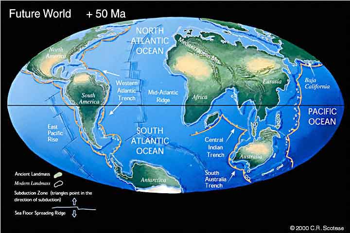
    Also, I have been looking at Paleoworld for advice on how the plates will be shifting, but the soonest future world they have is 50+ Million Years in the future. How much change will 5 Million Years have caused? Will the Mediterranean have closed up by then? How far will Australia and Antarctica have moved? Are there other resources for Plate Tectonic projections?

    Thanks all.

  2. #2
    Guild Apprentice
    Join Date
    Jul 2007
    Posts
    44

    Default

    There are a lot of views, but no replies.

    I'm looking to create a middle ground between these maps:


    I can hand-draw it, but I'd like to create organic looking coastlines. I understand that a number of people use fractal map generators when creating new coastlines, but how would I go about defining coastlines of Earth after changing the sea level? I don't need them to be 100% accurate to earth (especially because the people of the world I am creating won't have perfect mapping capability), but I'd like to make them look good.

    Also, does anyone have resources for how the climate should change during an ice age? I've been scouring the internet for sources, but I'm coming up fairly empty.

    Thanks.

Posting Permissions

  • You may not post new threads
  • You may not post replies
  • You may not post attachments
  • You may not edit your posts
  •