


Hey all. This is my first post here.
I got it in my head that I should make a map about a month or two ago, so I started doing some research online and found this place. I've been lurking for a while and looking at all the different types of maps here for inspiration and to see if anyone else has made something similar to what I'm trying to do. I was at the James Ford Bell Library the other week in Minneapolis, which is a huge archive of rare, old, and unusual maps, and the whole time I was there I kept thinking "cool, I want to do that." Basically, I'm wanting to make a map in the vein of ancient maps, where it's not really about navigation as much as a tour guide meets philosophical exercise. Something like Eratosthenes or Ptolemy. Small, simple, vague.
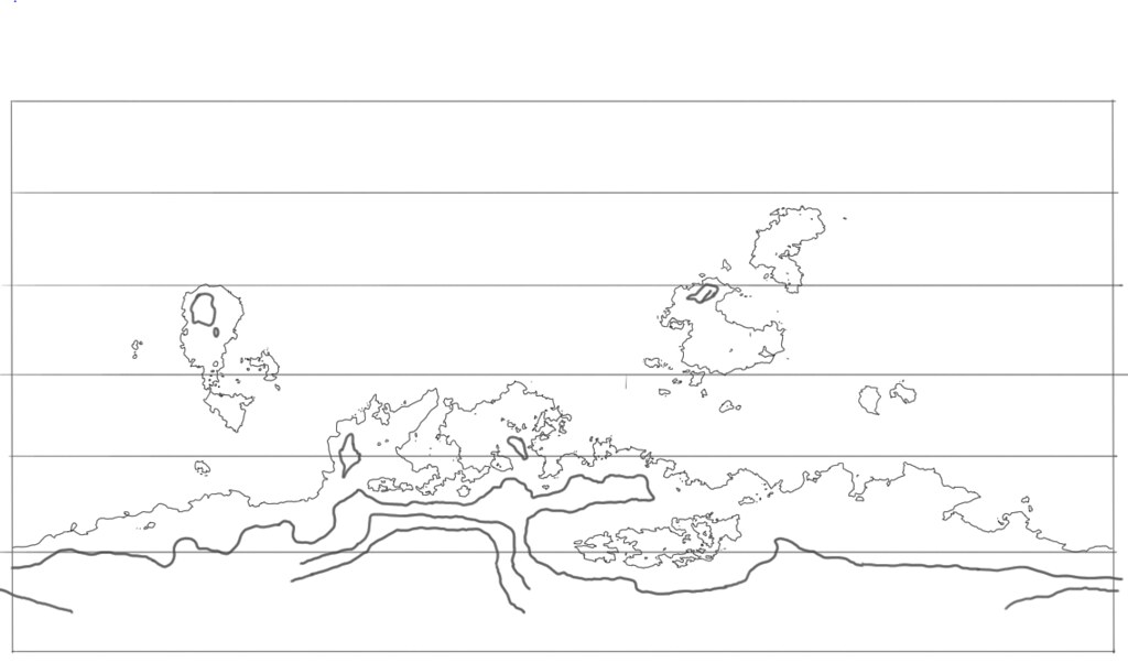
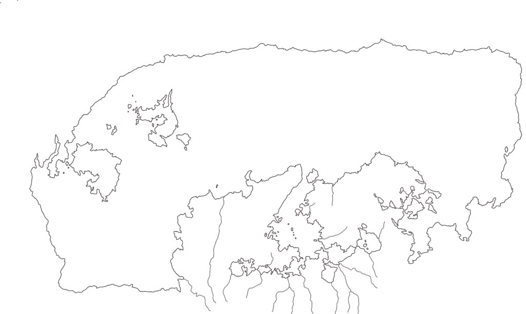
Of course, the charm of those maps is seeing how inaccurate they are, so I started off drawing a more accurate, if fairly simplified, world map (though in hindsight I drew may more than I needed). I interned as a surveyor for about a year and have a fairly decent background in geography (I'm an archaeologist by training), so I think it's all pretty reasonable. Here's what I started with:
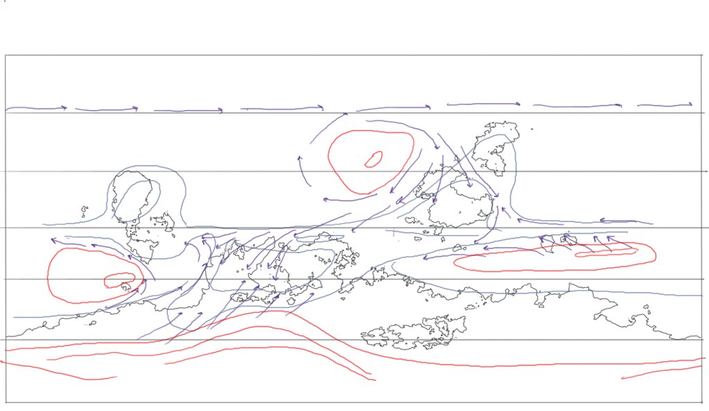
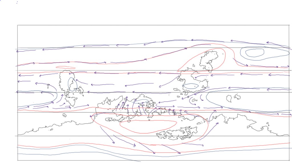
After that I did the pressure zones so that I could figure out the winds. They're pretty basic and dumbed down, as there's really no need for anything too complex here. Red is high, blue is low, purple are wind directions.
Summer:
Winter:
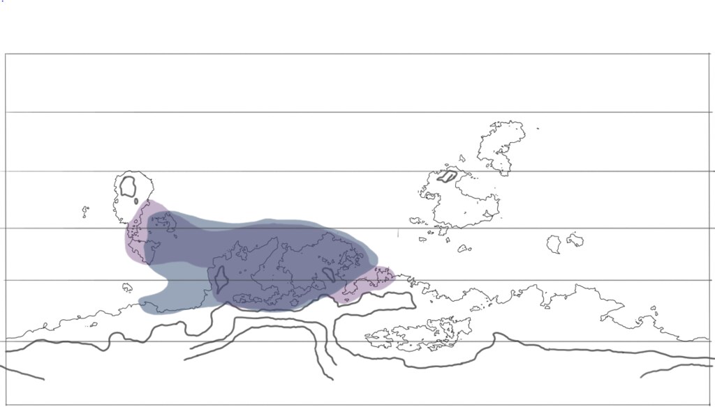
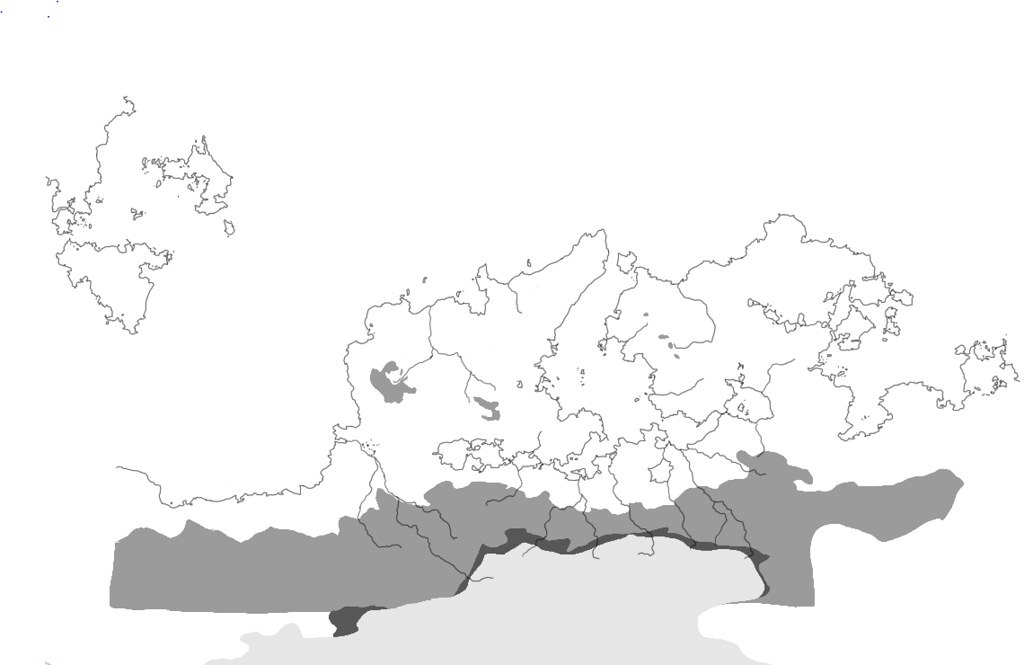
In addition to using this to figure out climates (which I'm not really going to show on the map, but will label) it lets me know which sea routes are most navigable. Bit of a side note here, I don't know if anyone here has ever read Colin McEvedy's "New Penguin Atlas of Ancient History," but he outlines a theory that when he placed a big grid over a map of the Mediterranean he noted that the where there were lots of coastal bumps and peculiarities in the littoral, seafaring cities and colonies would invariably be found there. So I did that over my map to figure out where the seafaring population of the world would be found, and made that where I'm centering my map on (in this case it's the big gulf/sea/basin-thing on the southern continent). So, looking at the wind patterns that move in and out of that area, I did a composite map to show accessible routes during summer and winter, which in turn basically shows what the known world would be (I also threw in mountains on this map, as that obviously would checker where you can and can't go:
So, with that in mind a did a close up on that region for me to base my map around:
And with that I could finally have some fun and do the distortions, inaccuracies, and weird philosophical conceptions of the earth I wanted to make. To the south of the region is a vast glacier, which is the source of most of the rivers in the area, so it's no leap of imagination that the people there would imagine that the glacier is ultimately the source of all water, and that the ocean is just a big enclosed pool of water that melted from it. Some of the other distortions are more practical, however. The further you get away from the frequently navigated areas, logically the less well known and mapped out it becomes, leading to some pretty huge distortions and misplacement (e.g. Ceylon on Ptolemy's map). So I ultimately came up with this map below. It's kinda fun (well, I think so at least) to do a back and forth comparison to the map above to see what they got wrong:
I'm tentatively naming the world Tēinīnm, which means "big pond" in the language I'm cobbling together for this, in reference to their conception of the ocean. Thematically, I suppose it's as good a name as any, given that the big pond is the centerpiece of the map.
And that's basically where I am thus far. Sorry for the deluge of maps, but I figure someone might find it interesting/useful to look at the process. Don't be fooled by the large number of maps either; it only took a couple hours to make all them thanks to cut and paste.
The next step is doing some coloring and basic decorations. I'm doing everything by hand on a tablet to give the whole scribal error sorta look to it, with shaky lines and occasional goof ups (besides, both of which come easy to me...). When I'm all done I'm hoping to make it look like it is a thousand years old or so, with heavy weathering, damage, fading, etc.
Any comments, suggestions, ideas, questions? If anyone has any further resources on ancient maps I'd be really thankful. I've done some research and tried to find out as much as I can, but it still feels like there's a lot out there I don't know anything about.

 Reply With Quote