


Here's a little map I was working on, and I'm not quite sure of the name yet. I was going for a kind of Middle Earth esque woodcut style. It's obviously not done yet but any critique would be appreciated.
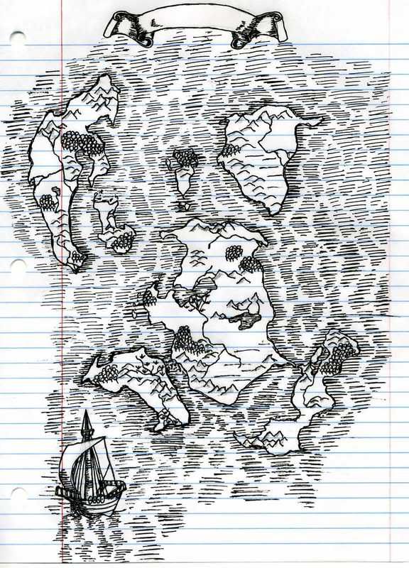


Here's a little map I was working on, and I'm not quite sure of the name yet. I was going for a kind of Middle Earth esque woodcut style. It's obviously not done yet but any critique would be appreciated.
Okay, Justin(time)--as a huge fan of good handdrawn maps I A) really like this, and B) really, really like this. Great first map post!
I think two improvements could have been made: 1, in places the hashing looks a bit too scribbled, which gives the impression you rushed (?), and 2) the lined paper was the absolute wrong choice, as it gives what is a pleasing map an amaturish look.
Finally, and this is just a compositional thing, perhaps outside the scope of what you imagine, water dominates the map, making your land masses appear very, very small. I would focus in on the islands a bit (and if they are continents, focus in a LOT, I say).
Still, great job. I'm so glad you joined the Guild and posted this. Looking forward to future incarnations!
Don
My gallery is here
__________________________________________________ _______
"Keep your mind in hell, but despair not." --Saint Silouan [1866-1938]
Yea, the lined paper thing is regrettable but I just sort of started sketching and didn't want to start over. I think I will work on doing five more maps, one for each of the islands and zooming in a lot more. And I definitely will do them on better paper!
The hashing is certainly rushed in places, just gets tedious to do. I'll have to work on that.
Justintime, do you have Photoshop or any other graphics software? Because the lines are blue & red, whereas the rest of your map is in black, these elements could be easily removed...
If you do not have such a program, you may want to download GIMP (it's free) and use it for that as well as many other touchups for your hand-drawn maps.
Don
My gallery is here
__________________________________________________ _______
"Keep your mind in hell, but despair not." --Saint Silouan [1866-1938]
Ahah! That's a good idea. And I have GIMP. My only question is how would I do it?
Here we are. Looks much better.
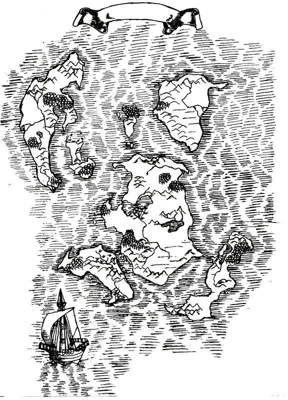
yeah, i would have to agree. first of all, it's a great map. i do find the seas a little busy though. perhaps on the next go round, you could just put thinner lines around the land masses only and leave the seas empty. cartographers of the time period in history you are trying to emulate would have left the seas bare, except for a poseidon or sea serpent image. just a thought. good execution by the way. it shows tremendous talent.
I was about to say what TM just said. Actually, since you've got it in an editor now, you could just erase a lot of the sea lines and leave them around the coasts only. The lines around the coasts already look much more deliberate than the ones in the open seas. Try it out and see if it looks good to you.
I also wanted to say that I like the cog. It has a very medieval drawing look to it.
Bryan Ray, visual effects artist
http://www.bryanray.name
Ok here is the version with the seas erased. I rather like the look of it this way, just looks cleaner and less overwhelming.

 Posting Permissions

 Reply With Quote


