


 Reply With Quote

A nice start with some good continent shapes and coastlines. My only comment is one of artistic balance ... you have a large empty (presumably ocean) center ... artistically you might want the center 2/3 of your map to be the main focus area.

Like I mention earlier, my main focus this year will be to work on my regular fantasy map style. This will be my first practice map, a smaller world map where I will try to convey a large scale. I have done some continental maps in the past, but never a map that really conveyed a larger scale
Here we have the initial outlines and texture (some test coloring don't know if I will follow that road).
Cheers,
Tainotim

Last edited by tainotim; 01-08-2016 at 10:13 AM. Reason: Updating picture
A nice start with some good continent shapes and coastlines. My only comment is one of artistic balance ... you have a large empty (presumably ocean) center ... artistically you might want the center 2/3 of your map to be the main focus area.
Thank you Chick! Not entirely sure I understand what you mean, but I would love to know if you could somehow show what you mean on the map!
(Updated the main picture with a little work on the coastlines, and some simpler brushes just to see how it could look. Never made any brushes before, but I will try to make some proper once for this.)
Cheers,
Tainotim
OK, I will try. But keep in mind this is just an illustration of what I meant, not any implication that you should change your map to my example.Originally Posted by tainotim

As a general composition guideline, something called the "Rule of Thirds" is about the most important. It says that the focus points of your image should be approximately 1/3 of the way from each edge of your image.
So here is your map with the 1/3 lines drawn on it:
Notice that the places the lines cross should be the primary focal points. Two of yours are empty and the other two are well toward the side of the western continent. If the main landmasses were placed so the focal point is roughly centered, that means about half the image would be toward the center of the overall map.
In your map, the center section is virtually empty:
That creates a sense that nothing is really important enough to look at, because it's all peripheral.
If you use the focus points to help you place the more important pieces of your map, that draws the eye to them, and makes a nice comfortable viewing balance to the image. I would pull the continents in toward the center so the Rule of Thirds focal points are the center of attention where you want the viewer to look.
This doesn't mean every map has to be drawn this way, but I thought in your map it really stood out how much of the map was on the outside 1/3's of the space.
I did a bit of cut and paste to move your continents around so that the main regions were at the focus points. Again this is just illustration of the use of the Rule of Thirds, certainly not intended to usurp your decisions about your map.
Here, the center contains more of the important structure of the map, while still maintaining the central ocean and surrounding circle of landmasses. I hope this helps explain what I meant with my comment.
https://creativemarket.com/blog/2014...irds-in-action
https://en.wikipedia.org/wiki/Rule_of_thirds
It's a gorgeous job of drawing landmasses!
Cheers,
Cornelia
Thank you for taking the time to explain Chick, I definitely see what you mean now, and it's a great point! The original really circles the center. Not sure if I will change it for this practice, however, I will keep it in-mind for future mapping
Cheers,
Tainotim
Interesting discussion (and very nice start!). I would say : the ocean in itself can be consider as a major/central feature if it's a hub for commercial roads between continents. A bit like the mediterranean sea on a Roman Empire map.
Thank you Ilanthar.
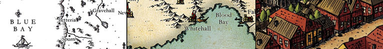
Some practice with a set of brushes I put together. Mountains and hills. Not sure if I like it or not, hard to tell, I will just have to keep on going
Cheers,
Tainotim

Last edited by tainotim; 01-09-2016 at 01:56 PM. Reason: Updated picture with some rivers etc


I just did a similar thing. It's pretty easy and fast. Yours brushes look better than mine and I think that would work! I guess variety does the trick.
All in all I'd say you're headed towards a nice standard with that style.
I'm loving the style of this. It looks great.
"We are the music makers, and we are the dreamers of dreams"
Thank you. This is where I am right now. I'm really struggling to figure out how to color the land and water in a good way, but it's difficult, puh. Any suggestion on this are more than welcome.
Cheers,
Tainotim

 Posting Permissions
