Reply With Quote
Hmmm. I can see them fine. I am not a web guru so I have no idea why they are not showing up for you. I'll try poking around with them abit tonight to see if I can get them to show up in a different fashion.

I don't know whats wrong with my setup but i can't see the links
Pat
The truth detective
www.patoumonde.com


Hmmm. I can see them fine. I am not a web guru so I have no idea why they are not showing up for you. I'll try poking around with them abit tonight to see if I can get them to show up in a different fashion.
Well-
I just discovered that photobucket is blocked by some content filters (including dans guardian the one I just installed at home). Once I added it to the exempt list these (and the image in your intro post) are visible.
-Rob A>
My tutorials: Using GIMP to Create an Artistic Regional Map ~ All My Tutorials
My GIMP Scripts: Rotating Brush ~ Gradient from Image ~ Mosaic Tile Helper ~ Random Density Map ~ Subterranean Map Prettier ~ Tapered Stroke Path ~ Random Rotate Floating Layer ~ Batch Image to Pattern ~ Better Seamless Tiles ~ Tile Shuffle ~ Scale Pattern ~ Grid of Guides ~ Fractalize path ~ Label Points
My Maps: Finished Maps ~ Challenge Entries ~ My Portfolio: www.cartocopia.com
I've done lots of hand-drawn work - because I run my own repro shop/digital graphics studio, I have the kind of tools, like you, in doing large format work.
I've learned from experience, that I don't have to create an entire hand-drawn map on a single sheet of paper. I create the continental coastlines and islands first, place some pretty details, then scan that in. All other geographic content is drawn (at the same scale), but isolated as separate drawings from all other features, then I scan and place them on the map. The final still looks like all work was done on one sheet of paper, but actually involved dozens of sheets creating much smaller areas than all at large format.
My entry for this month's Challenge map, was done this way, though I added some digitally created beveled features with the hand-drawn work. The forests, mountains and hills were drawn separately then composited with the final map. You can even see the stages I went, through my WIP starting on the first page.
Working with a giant piece of paper is lots of work. I prefer the same result, but created much easier as a composite of many drawings.
Of course, if what you're looking for is a hand-drawn artistic masterpiece to display, my method won't work for you. For me, everything becomes digital eventually, so I can distribute the maps or post them in forums like this - or so I can print them in large format color at intended scales.
GP
Last edited by Gamerprinter; 09-16-2008 at 11:07 PM.
Gamer Printshop Publishing, Starfinder RPG modules and supplements, Map Products, Map Symbol Sets and Map Making Tutorial Guide
DrivethruRPG store
Artstation Gallery - Maps and 3D illustrations
Thanks GP.
Tons and tons of great advice available here on the forum. I will be sure to try out putting together a map coming up in pieces as you suggest.
As a side note, some tiny voice in me wants to keep at it with the large hand drawn bits. It will force me to practice caligraphy for the lettering and get creative in drawing my own symbols and such.
As you say, in the end I wind up with a big hand drawn map I can add to my collection. There is something, I dunno...quasi mystical for me in sitting down to do one of these big hand drawn pieces on parchment. I know, I know, that sounds crazy and wierd. Somehow doing it myself without a computer being involved beyond scanning the final piece in at the end makes it feel like I'm carving out some little corner of a fantasy setting with my own two hands and that's kind of cool.
Of course I seem to have zero problem dumping the entire hand drawn bit and doing work strictly off the computer for science fiction bits.
I must be getting quirky in my advancing age. Laugh.
Ed
Like I said, if a final single piece of hand-drawn work to display in your collection, that is certainly a great way to map. And you're right doing it the old fashioned way, gives one a certain satisfaction in the work.
For me, I create 30 - 40 maps per year, this of course doesn't count dungeon tiles, which I create several hundred a year, as well as creating 250+ map objects per year. I love creating maps, and I also love doing hand-drawn work as a part of my method of creation.
Creating so much work in a single year, makes it impractical for me to do the one sheet map design by hand, for all the maps I create - I need short cuts to make things practical, after all I am in business doing this too.
Go for the one sheet of parchment map, its admirable and highly satisfactory.
Do try a pieced composited map, its worth the effort, because at least in its final format (after you scan in your final map) there really should be no difference in the look - its still your hand-drawn work afterall.
GP
PS: so you're name, is that like "Arthnek and Old Lathe?" JK...
Last edited by Gamerprinter; 09-19-2008 at 06:00 PM.
Gamer Printshop Publishing, Starfinder RPG modules and supplements, Map Products, Map Symbol Sets and Map Making Tutorial Guide
DrivethruRPG store
Artstation Gallery - Maps and 3D illustrations
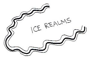
My turn to say nice map! I've added some rep your way as well. As for the ice fields, how about a wavy line with a similar but thinner line on the inside and outside? Basically trying to get that reflecting/refracting effect ice has on ice.
Here's a very rough drawing of what I had in mind...
Actually I was thinking the lines should be closer together. I'm sure you could do better.
Cheers,
Tim
Paratime Design Cartography
"Do infants have as much fun in infancy as adults do in adultery?" - Groucho Marx
Etruria and Amazonia are real places
Your lettering is beautiful...did you do it freehand? I'm really impressed. That's not to take anything away from the map itself which is magnificent. I can't wait to see it coloured.
Thanks Ravells.
I plan to do afew smaller map projects (by smaller I mean 24x36" instead of the huge banner) all the way through coloring before I try to tackle painting the big map.
Probably two more to get afew areas cleaned up. I did post a finished hand painted map at the link below under the Regional Maps heading in case you want to see how it looks.
http://www.cartographersguild.com/showthread.php?t=2969
Thanks for the compliment on the lettering. Yes it is just hand lettering. Next go around I plan to get my act together and use a caligraphy pen to make the lettering more interesting.
Ed
 Posting Permissions