Page 1 of 4 1234 LastLast
Results 1 to 10 of 32

Thread: Setting Unnamed - World Map in progress.

  1. #1

    Default Setting Unnamed - World Map in progress.

    Greetings. I'm happy to find out theres an entire forum dedcated to people who like fantasy cartography. Figured out this would be the right place to ask for some pointers regarding a map I'm trying to make.
    Click image for larger version. 

Name:	worldmapnew_zpsq82erja9.png 
Views:	106 
Size:	21.3 KB 
ID:	70705
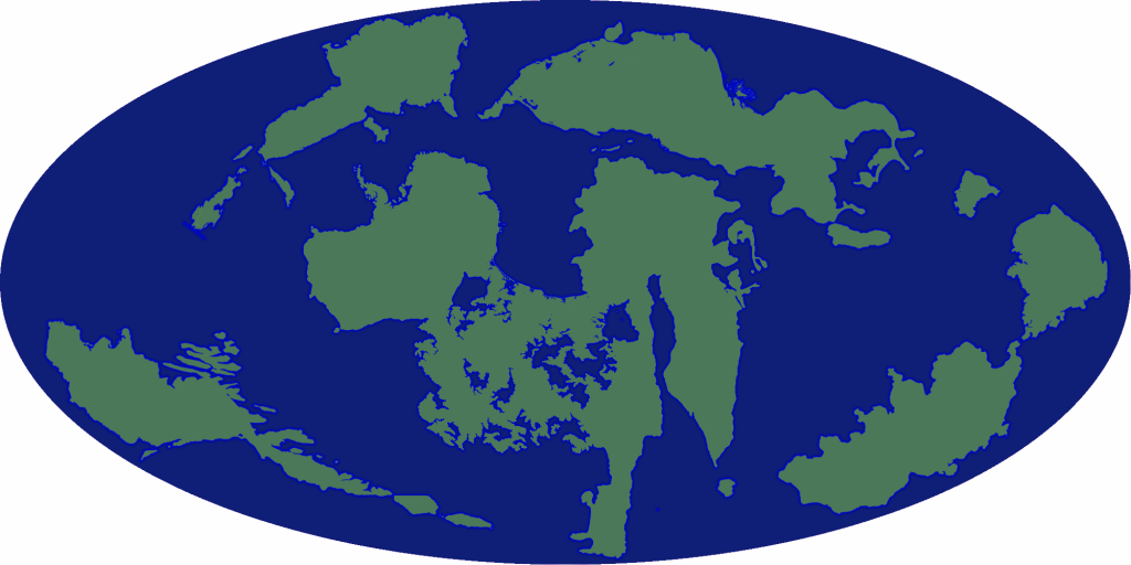
    I chose a Mollweide-like pseudocylindrical projection with a specific purpose. The typical fantasy map benefits from a shape-constant projection, because it's easy to figure out which way is north, thus easier to plot all those journeys there and back again. That's not the purpose of this map, which is primarily political. I want to establish the main players in the world scale and how they relate to each other, so big area distortions would give the wrong impression.

    My main questions are: How's the land/water ratio? Do you think I should fill in some of those inland seas in the middle continent so it's more of an unified landmass? What can we glean from the shape and position of the continents alone? (I can give you a bit of info about who's gonna go in them if you think that would be useful)

    I intend to keep showing new versions of the map as I make progress on it. Hope you like =)

  2. #2
    Guild Artisan
    Join Date
    Sep 2014
    Location
    Paris & Berlin
    Posts
    610

    Default

    Well one of the problems I see is that fractal cartography software like Wilbur or FT work with cylindrical projections. At the end you may always export the result in Mollweide but the whole work happens in cylindrical.
    So having Mollwaide as start, it would be interesting to transform it in cylindrical for farther work if you want to use realistic fractal height field generators.
    The alternative is doing everything by hand.

  3. #3
    Guild Grand Master Azélor's Avatar
    Join Date
    Jul 2008
    Location
    Québec
    Posts
    3,363

    Default

    Like Deadshade mentioned, it's easier to work with another starting projection : Equirectangular. Most software use it as their default map projection and you can then convert it to Mollweide.

    To answer your question: the % of land is 35,2%.

  4. #4

    Default

    Thank you! I'm a beginner when it comes to mapmaking, this is my first attempt at something more than random Paint squiggling and fill-in. =) I'm doing it by hand because I either don't have or don't dominate the tools at the moment. My main concern is making a reasonably informative map that isn't too ugly.

    To answer your question: the % of land is 35,2%.
    Thanks! I really should shrink some continents a little bit then.

  5. #5

    Default


    Version 3, now with fancy borders and somewhat appropriately positioned islands.

  6. #6

    Default

    I wonder if there's someone to help me with this...

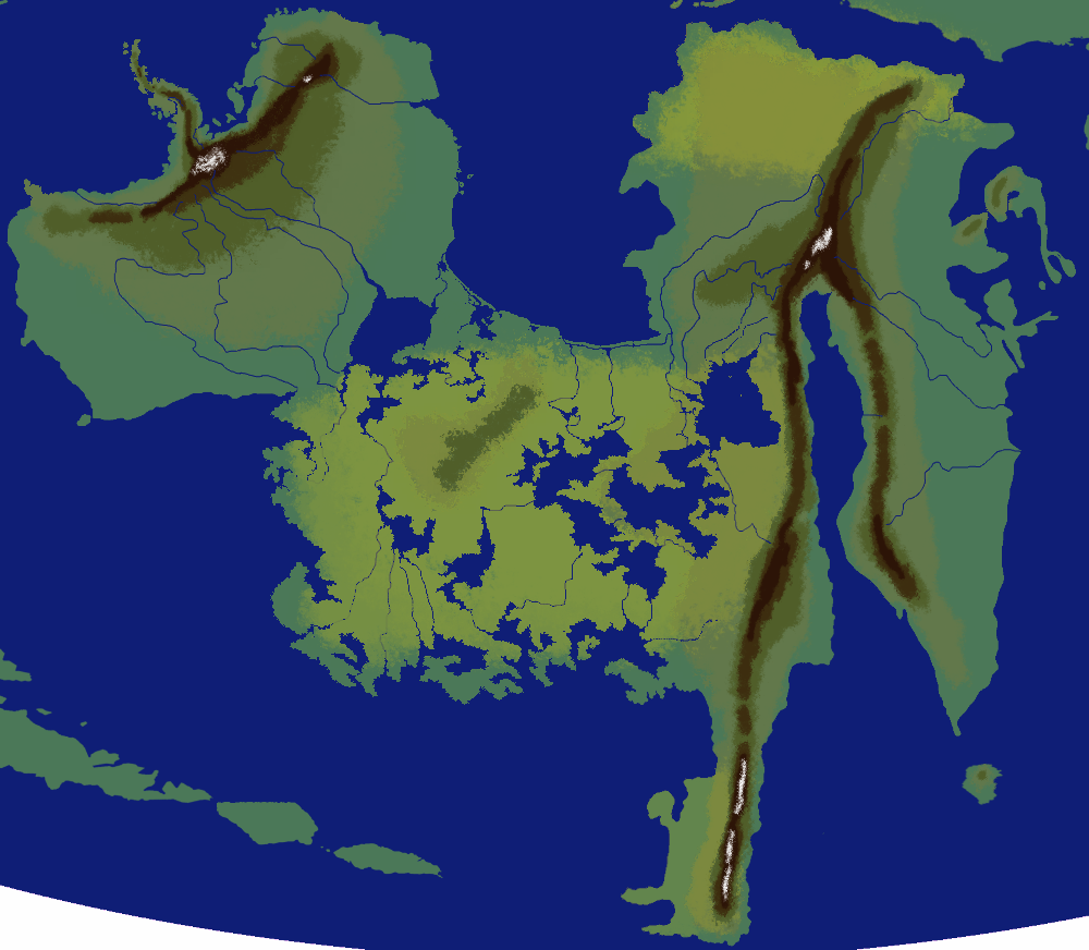
    According to my crude climate model, the middle region in the big continent is going to be mostly arid. The question I'm asking is how much those massive inland seas/lakes are going to affect that?

  7. #7
    Banned User
    Join Date
    Jul 2014
    Location
    Traverse City, Michigan, USA
    Posts
    2,547

    Default

    As long as you don't put a large mountain range on the western side, the interior of your main continent should be plenty humid. Arid regions tend to be downwind of mountain ranges, and with large bodies of water in the center, there should be plenty of rain.

  8. #8

    Default

    Quote Originally Posted by chick View Post
    As long as you don't put a large mountain range on the western side, the interior of your main continent should be plenty humid. Arid regions tend to be downwind of mountain ranges, and with large bodies of water in the center, there should be plenty of rain.
    Hm. I must have done something wrong then. I thought the wind would come from the east side, and get blocked by the mountains I put there.

  9. #9
    Banned User
    Join Date
    Jul 2014
    Location
    Traverse City, Michigan, USA
    Posts
    2,547

    Default

    Depending on the latitude, the prevailing winds may be E or W. In either case, the arid region would be downwind of the mountain range.

  10. #10

    Default


    Eh, I tried. I still don't know how to represent forests.

Page 1 of 4 1234 LastLast

Posting Permissions

  • You may not post new threads
  • You may not post replies
  • You may not post attachments
  • You may not edit your posts
  •