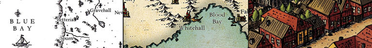
Very cool Sarithus; you have quite a talents for these illustrative maps. Will you color this one or keep it BW? The border is very impressive.
Now, for some very picky feedback(mostly just personal things that I prefer, but perhaps it might help). The "details" on the hills are drawn more horizontal then the mountain more vertical approach. Personally, I think that it looks better when mountains and hills are more congruent in this aspect

The way you do the waves in the lakes gives them a more "top down" feel compared to how you did the body of water just left of the IMPERA label. It helps to confuse the sense of perspective.
And last, I think that the "Aiurak Forest" blends in too much with the marshes and hills. Gives a very strange sense of perspective, if you just look at that part.
Concerning the signature on BW maps: I rarely even think about someone stealing my work, unless it's a commission map and I know that someone actively wants it. Otherwise, I'm more in the state of mind that even if someone stole it, I would probably never know that they had(For the world is dark and full of terrors).
Looking forward to the next awesome update!
Cheers,
Tainotim


 Reply With Quote
(not strictly related to this post
)