Page 1 of 3 123 LastLast
Results 1 to 10 of 23

Thread: Purely Fictional Planet, Critique Encouraged

  1. #1
    Guild Novice Facebook Connected CarnivorousJellybean's Avatar
    Join Date
    Sep 2015
    Location
    Canada
    Posts
    18

    Wip First Fictional Planet, Critique Encouraged

    NOTE: TK and Azelor provided feedback before I updated this post (and thank you so much for doing so, you two!), there are some points which I hadn't mentioned here when they made their posts. For clarity, I'll put a little * at the beginning of sentences I've edited.

    Short Intro
    This is sort of a collaboration between me and my boyfriend since we're both huge nerds. It started out as a simple thought experiment: "how would our world have to change for steampunk be a thing?" and quickly evolved into building a whole world with different cultures, global trading systems, and DRAGONS (biology's my main contribution). Basically a place for all our fun daydreaming moments to take place (and possibly for me to hold a D&D campaign in at some point). However nerdy we are though, neither of us are experts in cartography or geology, so help/critique would be appreciated.

    Map
    I believe these can be clicked for a higher resolution, though I recommend no larger than 33% of the maximum size for the world-map or it starts to look fuzzy and strange from all the manipulations I've done. The spherical maps are done by overlaying the full map into Google Earth and taking screenshots (so no work on my part)
    Click image for larger version. 

Name:	Labelled_World Map of Major Continents.png 
Views:	147 
Size:	2.40 MB 
ID:	76540
    Whole world, labelled so hopefully it's more useful
    Attachment 76541Attachment 76542
    Aainmhar and Eira
    Attachment 76543Attachment 76544
    Northern and Southern poles - *I drew the north pole while looking at maps of Earth for help with how much stretching should be added, so it came out a little similar to Antarctica.
    Attachment 76545Attachment 76546
    Unnamed Continent and a really long archipelago - *The southern tip of the unnamed continent was made from islands in the Philipinnes and Indonesia because I found their layout aesthetically pleasing. Is this an okay thing to do or is this as bad as an artist tracing someone else's work?

    More Information
    I haven't been super fussy about plate tectonics or anything like that - *mostly because I don't understand them. Quite a few of the decisions (like the archipelago in the last picture) were purely artistic. The planet's supposed to be Earth-like, same axial tilt, diameter, and density. The planet hasn't been named, but some of the places have. Basically Brekanburg's like their equivalent of Europe. Aside from that, the little ring of islands called Serpentlyre is probably giving some experts a headache right about now (and I'm sorry for that).

    Some of the areas are super blurry and stretched looking at full-res, *this is because I started with very flat images of my continents and had to contort them to look like a Mercator projection. *The ones where it goes straight from black to white are a result of changing the thresholds in photoshop, whereas the slightly blurry edges are from me painting in areas. The style's probably pretty boring (white continents on black), but it makes it easy for me to change the layouts and warp the continents with very little extra work - unlike if I had painted in biomes.

    So uh, what do you guys think? Is it too similar to Earth? Any pro tips? Continents too small/large? Anything so unrealistic that it's making you want to rub my face in it until I understand your point of view?
    Last edited by CarnivorousJellybean; 10-06-2015 at 07:28 PM. Reason: Made the thread title clearer, clarified a few other points as well.

  2. #2
    Guild Journeyer TK.'s Avatar
    Join Date
    Jan 2015
    Posts
    119

    Default

    Hmmm... just my humble thoughts so far

    - I'm not from River policy or anything, but your map seems to be missing more rivers. A lot more of them.
    - If the planet's supposed to be Earth-like, as you say, you'd invariably need to at least have a wild guess where your tectonics are to form mountain ranges and alike. You could simply look at Earth tectonics for ideas
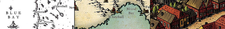
    - The "center" continent looks a lot more blurry than others
    Drawing skills? What drawing skills?!

    My Deviantart

  3. #3
    Guild Grand Master Azélor's Avatar
    Join Date
    Jul 2008
    Location
    Québec
    Posts
    3,363

    Default

    Yes it does look like Earth since you copy pasted Indonesia, the Philippines, Europe and possibly other places right on the map. It's ok if it's an alternate earth but it look odd for a fictional world to have places just like on Earth.

    Furthermore, these are fuzzy as if they had been stretched while the other parts are clear-cut black and white.

  4. #4
    Guild Novice Facebook Connected CarnivorousJellybean's Avatar
    Join Date
    Sep 2015
    Location
    Canada
    Posts
    18

    Default

    Rivers sounds like a good idea, might need to make the map higher res for that- or is it okay as is? I'll definitely take a look into tectonics while I'm at it as well.

    Oddly enough, I didn't copy Europe (though part of the unnamed continent and the pear-shaped one - specifically the southern tips - are the Philippines and Indonesia warped a fair amount). Fun side-fact: the western continent started as a drawing of a pear. Thanks for pointing out the stretched-ness though, I wasn't sure whether it was too apparent at higher resolutions; the middle continent's the one I've transformed and warped the most, so that's probably why. I'll go back and fix that part right away!

    Thanks for the suggestions, TK and Azelor!

    Also, just a little note: please tell me if I'm doing/saying anything in a manner that's generally frowned upon on these forums. I'm new and it takes me a while to adapt to new communities (which I realise is hardly an excuse if I manage to break any actual rules). I know the basics: be polite, don't get overly defensive from critism, double-posting, bumping a thread already on the front page, and posting in really old threads are things to avoid. Outside of that though, I'm afraid my new-ness is showing

    UPDATE
    I made a stab at tectonic plates and also tried to clean up the lines a bit on the base map.
    Click image for larger version. 

Name:	Tectonic Plates.png 
Views:	70 
Size:	1.33 MB 
ID:	76574
    Click image for larger version. 

Name:	Simple_World Map of Major Continents.png 
Views:	92 
Size:	464.4 KB 
ID:	76573
    Rivers were deleted (I'm sorry river police!) because I figured it's best to know where the mountains are first before I start adding in flowing water - and I need to know how the tectonics are moving to know where the mountains are. This is all making my head spin!
    Last edited by CarnivorousJellybean; 10-06-2015 at 08:35 PM. Reason: Couple spelling errors

  5. #5
    Guild Artisan Charerg's Avatar
    Join Date
    Feb 2015
    Location
    Finland
    Posts
    525

    Default

    Well, as far as the tectonics goes, you need to somewhat rework your plates. Remember that you're depicting a spherical surface, which means that the northern and southern sides of the map are in reality a "single point". In the current layout both the North Pole and the South Pole are divided between several plates.

    Checking your world in Map-to-Globe is a good way to see how it looks like in 3D.

    Btw, you sure you didn't copy Europe to the unnamed continent? Because if not, the similarities are extreme. I mean, you've got Scandinavia complete with the Kola peninsula and Lake Ladoga, Greece is plainly in there, as well as the Crimean...

  6. #6
    Guild Artisan Pixie's Avatar
    Join Date
    Jan 2014
    Location
    Lisbon
    Posts
    939

    Default

    Quote Originally Posted by CarnivorousJellybean View Post
    Oddly enough, I didn't copy Europe (though part of the unnamed continent and the pear-shaped one - specifically the southern tips - are the Philippines and Indonesia warped a fair amount).
    Quote Originally Posted by CarnivorousJellybean View Post
    (...) please tell me if I'm doing/saying anything in a manner that's generally frowned upon on these forums.
    Can't speak for the forum particular etiquette, but lying is something I generally frown upon.

  7. #7

    Default

    Don't worry about being impolite or anything Carnivorous. You seem like a great person to me! And I honestly don't see a problem with any similarities to parts of your map with our world-map. It's not like anyone here "owns" the rights to maps over the Philippines and Indonesia or whatever. Long as you are happy with the result that's all that matters. And if you are unhappy with the similarities that can be found, hay, guess you got some great feedback here!

    Now concerning your map, I'm way out of my element with this kind of hardcore mapping. However, what you have so far looks great

    Keep up the good work, and the great attitude.

    Cheers,
    Tainotim

  8. #8
    Guild Adept Barek333's Avatar
    Join Date
    Sep 2011
    Location
    Stuttgart
    Posts
    385

    Default

    I mean it isn't any sort of a problem to make the map from whatever you want to make it, it is your map in the end. But why then later saying it has no elements of Europe when I can see the whole Europe at least once, Greece twice, Turkey..Actually I think three of your four biggest landmasses are/could be Europe distorted in different ways. And exactly like tainotim said in his whole first paragraph: your map, you put whatever you want, perfect

    I just dont get why then deliberately lie about putting Europe in? O.o I mean did you want to test us to see if we wouldn't notice or what was the point of this little 'exercise'?

    Cheers,
    Barek
    I'm allergic to pollen! - Amaranthus hypochondriacus

  9. #9
    Guild Novice Facebook Connected CarnivorousJellybean's Avatar
    Join Date
    Sep 2015
    Location
    Canada
    Posts
    18

    Default

    Oh dear, I'm sorry if I came across as lying or trying to test anyones knowledge about the Earth's geography. That certainly wasn't my intentions. I'm afraid any attempts at explaining will only seem like me trying to cover my tracks or offer lame excuses, but that's better than ignoring everything that's been said, right?

    So to elaborate a bit, all the continents, except the unnamed one, were based on coastlines I got using a fractal world generator (this one specifically http://donjon.bin.sh/world/). Note: this is before I started adding the Philipinnes and such to make the island chains. The unnamed one came about from copying the southern end of the western continent and then drawing the east/southern side using images of north-east Canada, specifically around Hudson Bay's lowlands, and Sweden because of how perforated with lakes the areas look. There wasn't any direct copying/tracing involved there, at least not consciously, but if you'd said I copied those areas, I would definitely understand and go "yes they inspired me".

    After that, I started working on making the coast more detailed using a tutorial I found on the forums (this one). The extra detail in the coastline followed by googling "islands" and using them as references. Anyways, that's not the important part; geography's not my strong suit (I'm afraid it never will be) - I actually had to google Indonesia to verify that it was one of the areas I'd used for creating my islands when Azelor pointed it out. Combining that with the number of islands and the amount I've tweaked this map over several months (I started working on it digitally back in July), and you get one very confused and embarrassed girl who swears she doesn't remember basing anything off of Europe. Thinking about it now, I probably worded a few things regarding copying/not copying a little too certainly(?), given my terrible memory and geography, which was a huge mistake.

    So TLDR: sorry if I managed to offend or upset anyone, and thanks for the feedback about the tectonics, Charerg, I appreciate it (and thanks for the encouragement, tainotim)!

    Edit: just realized Sweden's totally a part of Europe and one of the original influences for the unnamed continent. Wow am I making a mess here!

    Edit 2: also, if I didn't directly address something important that was said to me in a previous post, I'm sorry. I'll go back and reread them in a bit. This post was very much a panicked response to try and clear things up a bit
    Last edited by CarnivorousJellybean; 10-10-2015 at 08:32 PM. Reason: I'm an idiot

  10. #10
    Banned User
    Join Date
    Jul 2014
    Location
    Traverse City, Michigan, USA
    Posts
    2,547

    Default

    I'd say just forget it and start over fresh

    I like your map, it's got potential, so build on it.

    By the way, in my albums is "Greylandia" ... based heavily on the middle east coastlines. It's no big deal.

Page 1 of 3 123 LastLast

Tags for this Thread

Posting Permissions

  • You may not post new threads
  • You may not post replies
  • You may not post attachments
  • You may not edit your posts
  •