


It's been a while since I've posted here, but I've come across an especially tricky problem which I hope the experts here can solve. You see, for one of my projects I want to create a map of Earth... after a Pole Shift.
That is to say, I want to leave the positions of the continents largely intact, but I want to place the North and South poles at different locations. For instance, the North Pole might be at the position of the Arab peninsula - and then it would be located at the very top of the map (in a conventional map projection, that is).
This is hardly the first time someone had this idea - this site has a bunch of pole-shifted maps of Earth:
But unfortunately, if the author explains somewhere how he created those maps I couldn't find it.
And I feel that this should be the kind of problem for which a software solution should exist. There is already a software that can transform map projections - G.Projector from NASA. Unfortunately, the only map input format it accepts is an equirectangular projection:
Which, like any other map projection out there, distorts the shape and size of the land masses (especially near the poles).
So... does anyone here know of a reasonably simple way for creating a pole-shifted map of Earth? Ideally, I'd like to try out a bunch of different shifts...

Astrographer - My blog.
Klarr
-How to Fit a Map to a Globe
-Regina, Jewel of the Spinward Main(uvmapping to apply icosahedral projection worldmaps to 3d globes)
-Building a Ridge Heightmap in PS
-Faking Morphological Dilate and Contract with PS
-Editing Noise Into Terrain the Burpwallow Way
-Wilbur is Waldronate's. I'm just a fan.
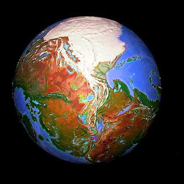
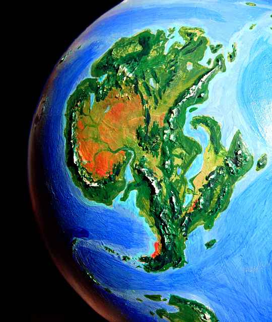
He probably painted a real 3D sphere like this one : http://www.cartographersguild.com/sh...ad.php?t=30877
Some might be able to provide more concise help by I tried to change the location of the pole with several software on different map projection and it's pretty limited.
Some work with Gprojector:
Molweide oblique
Hammer oblique
Orthographic (it's a sphere seen in 2D)
Dymaxion (not available with Gprojector)
There are other as well if you look into the available projections in the software but the distort the world a lot.
I don't know what is your actual map projection but equirectangular works as the input for most software because it's very easy to re-project it. Some projections can be re-projected but only with great approximations, like Winkel Triple.
I remember reading the World Dream Bank site years ago and he had mentioned the use of a real globe, plaster for landforms, and acrylic paint for colors. I couldn't find the description page when I took a quick glance just now, though.
I suppose I really ought to update the ancient ReprojectImage software ( http://fracterra.com/ReprojectImage.zip ) that I wrote years ago to convert various projections to Equirectangular. If I get around to doing the other half (project from Equirectangular to other projections), then it would make a nice general reprojection thing.
On the Winkel Tripel inverse subject, I suppose that fractional millimeter errors could be considered "great approximations" by some, but they are probably acceptable in practice for most purposes.


 Reply With Quote


