Page 2 of 4 FirstFirst 1234 LastLast
Results 11 to 20 of 39

Thread: Another map request

  1. #11
    Guild Novice Facebook Connected
    Join Date
    Jan 2016
    Posts
    21

    Default

    didn't see that post. I guess Fun with wilbur wasn't attracting enough for me to look at hahahahaha thanks again for your time.

  2. #12
    Administrator waldronate's Avatar
    Join Date
    Mar 2007
    Location
    The High Desert
    Posts
    3,554

    Default

    Finding good names for things has never been one of my strong areas. For almost 20 years my family had a cat that we called "Cat". My poor naming skills are especially amusing in light of the fact that I'm a professional software developer by trade and much of what I do is make names for things...

  3. #13
    Guild Novice Facebook Connected
    Join Date
    Jan 2016
    Posts
    21

    Default

    also a programmer. but it'.s not the same. usually when we program it's in a particular environment and variable names most often speak what we want them to do. although a tutorial. lolol

  4. #14
    Guild Expert johnvanvliet's Avatar
    Join Date
    Jul 2012
    Location
    N 42.39 W 83.44
    Posts
    1,091
    Blog Entries
    4

    Default

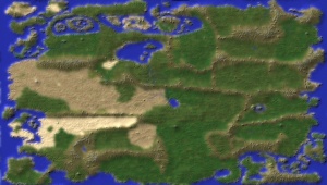
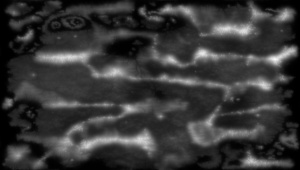
    just a quick color transfer to a Emboss of a height map
    2048 x 1160
    Last edited by johnvanvliet; 02-09-2016 at 11:03 PM.
    --- 90 seconds to Midnight ---
    --------

    --- Penguin power!!! ---


  5. #15
    Guild Novice Facebook Connected
    Join Date
    Jan 2016
    Posts
    21

    Default

    I'm still having trouble and you guys pump it out like nothing. lol
    Last edited by Michel Beaulieu; 02-09-2016 at 09:37 PM.

  6. #16
    Guild Expert johnvanvliet's Avatar
    Join Date
    Jul 2012
    Location
    N 42.39 W 83.44
    Posts
    1,091
    Blog Entries
    4

    Default

    Quote Originally Posted by Michel Beaulieu View Post
    I'm still having trouble and you guys pump it out like nothing. lol
    back in 2000 i moved from the photographic darkroom ( yes film ) to digital
    ( but i was using a computer in the darkroom back in 1989 )

    so for the last 15+ years i have been working with 16 bit and 32 bit scientific data
    ( msb 16 bit is a pain in the rear with out a PPC CPU computer )

    then in 2001 i found a Space Simulator and started making planet maps

    so do not feel bad it dose take time

    after over a decade of working with imaging data from USA and EU spacecraft , some things just get easy

    the link a few posts up has a few PDF's on using wilbur

    i really only use wilbur for adding rain erosion to height maps
    it is easier than using the FORTAN 90 code i was using


    For making the heightmap i used your image as a guide
    Made masks using the fuzzy select and growing the area ,then fuzzing the selected area and bucket filled with black or white
    ( you can still see some of the lines that are in the original )


    made a TALL mountain data set
    a lower mountain data
    then a plains level plasma noise data

    all from the input image

    then tapered the coastline with a darkening mask ( so the coasts are near sea-level )

    so a mix of three inputs and some masks and a lot of eroding
    Last edited by johnvanvliet; 02-09-2016 at 11:15 PM.
    --- 90 seconds to Midnight ---
    --------

    --- Penguin power!!! ---


  7. #17
    Guild Novice Facebook Connected
    Join Date
    Jan 2016
    Posts
    21

    Default

    I'll try it out. something tells me I'll screw it up also haha

  8. #18
    Administrator waldronate's Avatar
    Join Date
    Mar 2007
    Location
    The High Desert
    Posts
    3,554

  9. #19
    Guild Novice Facebook Connected
    Join Date
    Jan 2016
    Posts
    21

    Default

    OK, I managed to recreate my original map. (pen and paper) from 30 years ago for you guys. The uploaded version is 25% the real size. Before someone says it, how did that become a rectangular map? lol I'm guessing I was a limitation by the application used at the time of not, can't remember. I think I'll redo my land mass template from this one ect...

    Click image for larger version. 

Name:	map_25percent.jpg 
Views:	115 
Size:	2.39 MB 
ID:	80082
    Last edited by Michel Beaulieu; 02-10-2016 at 11:56 PM.

  10. #20
    Administrator waldronate's Avatar
    Join Date
    Mar 2007
    Location
    The High Desert
    Posts
    3,554

    Default

    Sometimes I can't help myself. I tried the V2 shader in Wilbur, and this is what popped out (after the usual shading and some piddling about with Photoshop):

    Click image for larger version. 

Name:	test2.jpg 
Views:	136 
Size:	531.5 KB 
ID:	80187

    One thing I left out in the most recent Wilbur tutorial-type thing was the used of Filter>>Morphological>>Erode as a near-final step. It will reduce the amount of fine-detail noise and give a more chiseled appearance.

Page 2 of 4 FirstFirst 1234 LastLast

Posting Permissions

  • You may not post new threads
  • You may not post replies
  • You may not post attachments
  • You may not edit your posts
  •