Page 2 of 5 FirstFirst 12345 LastLast
Results 11 to 20 of 45

Thread: WIP - World Creation (Mat'am)

  1. #11
    Guild Expert johnvanvliet's Avatar
    Join Date
    Jul 2012
    Location
    N 42.39 W 83.44
    Posts
    1,091
    Blog Entries
    4

    Default

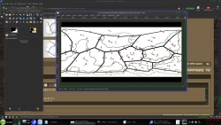
    or for moving a image that is in simple cylindrical to North Pole and South pole
    and back again ! gprojector can NOT do that

    Gimp has a built in tool called polar projection
    remap the north and south half into a polar projection
    work on it
    then remap it back into simple cylindrical

    for example :
    this image from above , not quite in Simplecylindrical looks to be a bit more Mercator
    that needs to be converted
    ( geo-referenced to 74 n to 74 s and remapped )


    then grab just the south and stretch it
    then remap it
    /filters / distorts / polar coordinates ( to polar )


    and work on it ( the plate at the pole is a bit "scrunched" )


    then remap back to simple cylindrical
    /filters / distorts / polar coordinates ( from polar )
    and past it back into the original image

    --- 90 seconds to Midnight ---
    --------

    --- Penguin power!!! ---


  2. #12
    Guild Artisan
    Join Date
    Sep 2014
    Location
    Paris & Berlin
    Posts
    610

    Default

    Quote Originally Posted by mwagner View Post
    Would it be safe to assume that the plates move with rotation and not just linearly?
    No. It would be quite unsafe.
    Imagine the convection cell like an underground cylinder with rotation axis parallel to the ground. The molten rock is rising on one side and sinking on the other side. The upper part of the cylinder is glued to a plate and moves it when it is rotating.
    So the plate can't rotate (in a plan orthogonal to the radius) because there is no force that would make it rotate. The cell is simply translating it.

    Of course this is a schematical representation, in reality the cell is not a cylinder but an irregular potato like shape but hat doesn't change the basic principle above.

  3. #13

    Map

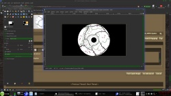
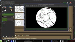
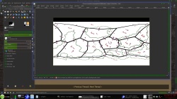
    johnvanvliet, thanks for the advice with gimp! I've been using Krita personally but I ported it over to GIMP to play with the polar coordinates. I like the end result. It looks much nicer at the poles now!
    I also went back and tweaked directions of plates (got rid of all rotation and tried to make the directions look right in polar coordinates and on the sphere. I think I'm pretty happy with the plates, and where I put the landmasses, but please let me know if anything still looks wonky. Also added the latitudes of 0, 30, and 60 (N ans S) for references.

    Click image for larger version. 

Name:	Tectonicstake2.jpeg 
Views:	52 
Size:	312.8 KB 
ID:	82323

    Click image for larger version. 

Name:	south pole map.png 
Views:	55 
Size:	540.0 KB 
ID:	82324

    Click image for larger version. 

Name:	north pole map.png 
Views:	43 
Size:	421.1 KB 
ID:	82325

  4. #14
    Guild Artisan
    Join Date
    Sep 2014
    Location
    Paris & Berlin
    Posts
    610

    Default

    It looks quite reasonable now.
    A minor comment would be that all your plates finish at equator what induces a kind of artificial N-S symmetry. However the equator doesn't play any special role so that some plates expanding both N and S of equator should exist .
    F.ex on Earth the Pacific plate expands from Antarctica to Alaska.
    There is Nothing pathological with what you did, I'd just break the N/S symmetry a bit.

  5. #15

    Map

    Hmm, I see what you mean. I think I'm gonna live with it for the moment. Mainly because I had a good chunk of free time and put in the land forms and I kinda like the shape of them and I would kinda hate to mess them up. However, if it still looks like there is too much symmetry even without the plate boundaries visible I will definitely go back and mess with them a little bit. Give the screen shots a critical look for me, it's often hard to see the errors in one's own work.

    With plate boundaries:
    Click image for larger version. 

Name:	Tectonicstake2.jpeg 
Views:	66 
Size:	402.1 KB 
ID:	82373

    and without:
    Click image for larger version. 

Name:	Landforms.jpeg 
Views:	54 
Size:	233.3 KB 
ID:	82374

  6. #16
    Guild Expert Facebook Connected Caenwyr's Avatar
    Join Date
    Apr 2012
    Location
    Flanders, Belgium
    Posts
    1,276

    Default

    I agree with Deadshade about the symmetry thing: there does indeed seem to exist a certain similarity between the plate boundaries and the equator, and the fact that both poles are still almost smack in the middle of their respective plates is probably even strengthening that impression. But I also agree with Deadshade that it's not impossible for plates to behave like this. Just a little improbable.

    Regarding your landmasses: I like them a lot actually!! They're interesting and quirky (in a good way!) and they just seem to invite you to explore further. What I'm not too happy with is their shape and position relative to the plate boundaries and especially the plate movements.

    Generally speaking adjoining plates can move relative to one another in three possible ways.

    1. They can diverge, in which case a trough will open up between them, which overtime can widen to thousands of miles. This is how the Atlantic was formed, and the same thing is currently happening to the Horn of Africa (a huge trough tearing through Africa, which will continue to widen until the sea moves in and separates both sides from one another).
    2. They can converge, resulting in colliding plates. One of those plates (the heavier one) will subduct between the other, lifting the other up and causing widespread mountain formation and volcanism along the rim. The Andes, Alps and Himalaya were all formed that way.
    3. The third and most interesting movement is lateral. Two plates gliding alongside each other, causing troughs to appear at some places along their edge, and ridges at others. The most famous example is the San Andreas Fault, which is currently grinding the Baja California Peninsula and SW California along the main mass of the North American continent in a roughly NW direction.


    The thing with you map is that places where plates undergo lateral movement, the land shapes don't always seem to match. The fact that there's a sea between T9 and T11 seems alright (they diverge), but there shouldn't be a sea between T9 and T10. At least not necessarily, and certainly not nicely along the plate boundary. It's just one of many examples.

    In fact, the best way to get your landmasses right if you start with tectonics is to sketch in the resulting topography around each of the plate boundaries first (regardless of which parts are underwater) - so mountains along all converging boundaries, troughs along all diverging ones and fragmentation and shearing along the laterally moving ones - and only then decide where your coastline will go. Thing to consider before doing the coastline: there are actually two types of plates - oceanic and continental - with oceanic plates being denser and not as tall as continental plates. The former will therefore lie lower, causing them to be generally below sea level, and when colliding with continental plates it is usually the oceanic ones that will subduct. But when two plates of the same density collide, which one subducts is entirely up to you. Yay!

    Some useful tips to get your coastline going: troughs will generally be submerged, unless they're still young like the Great Rift Valley, in which case it will be filled with strange lakes and fantastical endemic creatures. If they're undersea troughs, they will lie roughly in the middle of the sea they're creating, with coastlines on both sides looking as though they'd still roughly fit together (look at the Atlantic for inspiration). Mountain ranges will usually be above water, but some can extend a long way into the sea, and others can rise up from the ocean floor where two oceanic plates collide (like the Indonesian island arc). Lateral plate movement can cause the weirdest coastlines you can find. And if you'd like some island arcs in the middle of the empty ocean (think Hawaii), then realize these are generally caused by rising plumes of hot magma below the moving plates. A undersea volcano will rise until its peak breaches the sea surface, and as the plate moves along, this volcano will die and be eroded away, while a new one will form in its place. This is a rare process so don't overuse it, but it's interesting to know it's possible!
    Last edited by Caenwyr; 04-11-2016 at 05:29 AM.
    Caenwyr Cartography


    Check out my portfolio!

  7. #17
    Guild Artisan
    Join Date
    Sep 2014
    Location
    Paris & Berlin
    Posts
    610

    Default

    Quote Originally Posted by Caenwyr View Post
    In fact, the best way to get your landmasses right if you start with tectonics is to sketch in the resulting topography around each of the plate boundaries first (regardless of which parts are underwater) - so mountains along all converging boundaries, troughs along all diverging ones and fragmentation and shearing along the laterally moving ones - and only then decide where your coastline will go. Thing to consider before doing the coastline: there are actually two types of plates - oceanic and continental - with oceanic plates being denser and not as tall as continental plates. The former will therefore lie lower, causing them to be generally below sea level, and when colliding with continental plates it is usually the oceanic ones that will subduct. But when two plates of the same density collide, which one subducts is entirely up to you.
    Totally agree with Caenwyr. This is the way how it has to be done. If you start with tectonics, the topography is IMPOSED upon you by the plates. The other way is to impose the topography and then to try to do the plates consistent with this topography.
    The latter is generally more difficult and people mostly run in inconsistencies and contradictions. There must be a reason why mother Nature makes it the other way round

    A undersea volcano will rise until its peak breaches the sea surface, and as the plate moves along, this volcano will die and be eroded away, while a new one will form in its place.
    This may be misleading as a new volcano doesn't form "at the same place".
    The moving plate has a weak spot (imagine it like a hole). The molten magma below rises through this hole and creates volcanoes. But as the plate moves, the hole moves with it. So the next volcano will be farther in the direction of the plate movement.
    Finally after a long time you obtain a row of volcanic islands. As this row is rather straight, it shows that the plate translates without much rotation (subject we discussed above).
    Hawai is such an example of a line of volcanoes running straight from SE to NW.

  8. #18
    Guild Expert Facebook Connected Caenwyr's Avatar
    Join Date
    Apr 2012
    Location
    Flanders, Belgium
    Posts
    1,276

    Default

    Quote Originally Posted by Deadshade View Post
    This may be misleading as a new volcano doesn't form "at the same place".
    The moving plate has a weak spot (imagine it like a hole). The molten magma below rises through this hole and creates volcanoes. But as the plate moves, the hole moves with it. So the next volcano will be farther in the direction of the plate movement.
    Finally after a long time you obtain a row of volcanic islands. As this row is rather straight, it shows that the plate translates without much rotation (subject we discussed above).
    Deadshade explains it way better than I did
    Caenwyr Cartography


    Check out my portfolio!

  9. #19

    Map

    Wow! Awesome! Thank you guys! So, going back I took another look at my plates (the image is a little messy but its kinda like 'thinking out loud image'). I went ahead and tried to break some of the symmetry of the plates like Deadshade mentioned and had the northern pole plate off center of the pole and extended a few plates over the equator. Then I went back and put in a lot more directional lines to help me make sense of the plate boundary types. I know that straight lines will be skewed the closed it gets to the poles so I used polar coordinates on the poles themselves and am just going with straight lines else where for my own comprehension. Then I color coded the boundaries: Blue is collisions ('mountains'), green is diverging plates (troughs), and purple/pink is the lateral movements (the weird ones). I get the idea behind the lateral movements, but what about when they are moving laterally in the same direction? Does it depend on which plate is 'faster'?

    Click image for larger version. 

Name:	Tectonicstake3.jpeg 
Views:	54 
Size:	681.8 KB 
ID:	82414

    For example T10 and T6 if T10 is faster is it colliding into T6, but if T6 is faster is it pulling away from T10?

    T2 and T3 make sense, classic lateral movement so a few random mountains poking through the water, and significant seismic activity in the nearby regions. Check. Its the 'oddball' directions that are throwing me for a loop.

    Here's another image, this is more of me trying to figure out what I'm thinking and how it might look if I'm on the right track.
    Click image for larger version. 

Name:	Landformstake2.jpeg 
Views:	53 
Size:	218.7 KB 
ID:	82415

  10. #20
    Guild Artisan Pixie's Avatar
    Join Date
    Jan 2014
    Location
    Lisbon
    Posts
    939

    Default

    Slowly, but surely, you're starting to show some grasp of the "infinitely delicate art of inventing tectonics on an imaginary planet"

    Seriously, I always pay special attention to these whole-world-from-scratch threads and I wonder where you'll get. For now, you have original and interesting land shapes. If you allow me, here's some suggested topics to improve your tectonics:

    Euler poles (your maths background will be sooo handy)

    The Wilson Cycle. And this super handy PDF about it !!

    And, if you can invest the time, this is the software you want... G.plates

    I'm on a rush, but there have been a number of past threads from people doing what you are doing, I'll search some and share if I find the time.

Page 2 of 5 FirstFirst 12345 LastLast

Posting Permissions

  • You may not post new threads
  • You may not post replies
  • You may not post attachments
  • You may not edit your posts
  •