Reply With Quote


Wow, these are absolutely fantastic!! Thank you for sharing with us. The colouring is gorgeous.

the dem data is easy to come by
for the earth there are many sources , like the strm 2.1
http://dds.cr.usgs.gov/srtm/version2_1/
for mars there is the gridded MOLA data
http://pds-geosciences.wustl.edu/mis...mgs/megdr.html
--- 90 seconds to Midnight ---
--------
--- Penguin power!!! ---
Wow, these are absolutely fantastic!! Thank you for sharing with us. The colouring is gorgeous.
"We are the music makers, and we are the dreamers of dreams"


These are really awesome! Very nice paint jobs, and that topographical detail is just... wow! I hope you'll share more of these with us in the future.
On a related note, I really wish there was more stuff like this at the Guild: dioramas, wargaming terrain, and just artisan crafted stuff in general. I always love it when people post hand made globes, woodcarved maps, etc.
My: maps ~ mapping freebies
Thanks for the comments everyone.
As johnvanvliet pointed out, the Space Shuttle Radar Topography mission data is a good source for terrain data. To convert DEM or GeoTIFF data into a heightmap image I use MicroDEM. I then take the heightmap into 3DS Max and use it to displace a high-resolution plane to create a 3D mesh of the scene, manually adding side-walls and a base. For some more complex scenes like the Hawaii and Crater Lake models I combined space-shuttle data with bathymetric data in Photoshop to create a continuous height-map above and below the water level.
NASA provides much of their data as .STL files, ready to print here: http://nasa3d.arc.nasa.gov/models/printable
Another good site for getting terrain data is: http://opentopography.org/
And lastly, for examples of Museum-quality, hand-made terrain models see: http://www.terrainmodels.com/index.html
Redrobes - yes you can use an acetone vapor bath technique to smooth out 3D printed models, but only if they're printed with ABS plastic. These are made with PLA, which can't be smoothed with acetone. The steps you see in the models are due to the Z-axis height setting. After each layer is printed the print head moves up by a tiny amount (usually 0.2mm) and deposits the next layer. This is what creates the layered appearance. The Valles Marines and Crater Lake models are printed at 0.1mm layer height for finer detail (takes twice as long to print, about 5 hours). When painting the models I deliberately dry-brush across the layers to accentuate their appearance, since they look like contour lines on a map I think they add something nice to the final model.
Sanderling - if you don't have a printer but want to get something printed, you can upload it to Shapeways.com and they'll print it for you. They have extremely high quality industrial printers that can do much smoother models than my consumer printer does. These terrains are printed on a Wanhao Duplicator I3 printer.
Here are a few more unusual ones...
Asteroid Vesta:
Hurricane Katrina:
Aristarchus Plateau, moon:

real height data ( or shape files)for other things are a bit more hard to find
and it can be in a flat simple cylindrical DEM or a 3d "cube" type format from PDS , or in a form of vertex format that is very similar to a *.obj mesh
a example of the pds "cubic" format
-- 4 Vesta
ftp://naif.jpl.nasa.gov/pub/naif/DAWN/kernels/dsk/
( this requires some very special software )
from NASA to ESA they are all over the place
Ceres - right now the ONLY height map is the one i posted from a vertex mesh
https://drive.google.com/file/d/0B6Z...ew?usp=sharing
comet 67p - esa and a third party have a few
http://blogs.esa.int/rosetta/2015/11...t-shape-model/
and a great mesh from
http://mattias.malmer.nu/2015/05/new...avcam-bonanza/
others are on the "small bodies node"
http://sbn.pds.nasa.gov/
-- here
http://sbn.psi.edu/pds/archive/shape.html
and
http://sbn.pds.nasa.gov/data_sb/comet_type.shtml#shape
hires data for Vesta
http://dawndata.igpp.ucla.edu/tw.jsp...DIA_2013_02_13
Last edited by johnvanvliet; 07-18-2016 at 04:52 PM.
--- 90 seconds to Midnight ---
--------
--- Penguin power!!! ---
Hey these are looking good.
I was saying that I have been playing about with similar stuff too. What I forgot to mention until John posted is that you can do this with Lidar data as well in exactly the same way and that is really cool. In the UK they have released a UK map of lidar data with a substantial coverage. If the link still works in the thread then its well worth a look. I wrote about it here:
https://www.cartographersguild.com/s...ad.php?t=31877
So I found some Lidar data of a hill fort and cut it with my machine and got the following. Have a look at Lidar data anyway - its well cool.
Redrobes - that hilltop looks amazing! Individual trees and walls! You should try painting it.
jonvanvliet - what software can read the .cub file in the Ceres zip?
that is a isis3 cube
gdal / qgis can read them
most astronomical imaging data ( of moons and planets) is in the PDS "img" format or the isis3 "cub" format or in fits format
isis3 = "Integrated Software for Imagers and Spectrometers" version 3
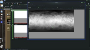
the pixel values are in Meters for the radii ( distance from the center )Code:gdal_translate Ceres.DEM8ppd.cub Ceres.DEM8ppd.tiff
subtract the minimum value ( 444366.5 )
then height is in Meters with the max height as 43252.36 meters
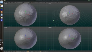
this heightmap can also be imported into Blender 2.77
Last edited by johnvanvliet; 07-18-2016 at 11:22 PM.
--- 90 seconds to Midnight ---
--------
--- Penguin power!!! ---
I know ! But I sprayed it white to match the renderings so that it could be compared to the data. Then I posted it to the chap who gave me the link to the lidar data. I could make another but theres only so many hours in a day to do all the fun stuff I like to mess about with.Originally Posted by monoRAIL

I have a photo of the real place too - Its Dolebury Warren / Rowberrow Hill Fort near Shipham and Churchill in Somerset UK. So this is at the top (top right) of the hill fort looking left. The hill in the middle distance is the one on the left of the lidar data. You can match up all the trees. On the original lidar data you can even see sheep tho they are blips in the pixels. Cars in other data are a couple of pixels. Its really astonishing the level of detail you get with it - it was a lot better than I had thought it would have been.
BTW: That ceres conversion is pretty nifty ! Theres so many DEM formats out there.
Last edited by Redrobes; 07-19-2016 at 05:11 AM.