Reply With Quote
I think your map style would benefit from an increased focus on the oceanic features. The features you already do have should be accentuated even more. Be bold!


Hello there,
i recently introduced myself in the Member Introductions Forum.
I previewed the creation of a Fantasy World Map there and since it takes me some effort to write readable English, I will just copy and paste a part of the Introduction in here:
I'm pretty new to the topic cartographie, I just came to it while I was creating a fantasy world for memory routes, and improving imagination... the whole venture was so fun, so I started taking things serious.
I wanted to create a world as logic and structured as possible. Of course location is an important part of this, so i decided to draw a little map with an app on my smartphone.
I thought a bit about climate and water currents, and created some layers, it was kind of fun but it turned out to be not detailed enough. It wasn't very pretty too. ^^
So I started creating a Photoshop file with my little map.
While looking up the needed skills for Photoshop I came across the awesome YouTube videos from Jan Loos, in which he's progressively creating a pretty awesome world map.
I decided to give it a try. I read some stuff about how tectonic movement, climate, vulcanos, mountains, and rivers come to live, and just started while watching the video Jan is creating his own map.
It took me some time, but I'm mostly finished for now.
The map should represent a prototype, which i´ll work on from time to time in the future, to improve it, part after part.
Since I'm not very profound with Photoshop the creation of the whole map from scratch took me like, idk, like 40+ hours, but it was very fun and worth it in the end.
Some things still need to be improved, like flattening the areas where the rivers flow through. I'm not that happy with the lakes too, so I may make some fundamental changes on these both things. The cilmate is a pretty big topic itself so there sure is spacke for improvement too. I also want to add some unique fantasy/scifi features, or areas to the continental / countire view.
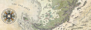
Here is the Map in low resolution, if you guys want to get deeper into it, you can read the rest of the description below, and take a look at the associated files I put in a OneDrive Folder.
Folder: https://1drv.ms/f/s!ArYQk8uyMD3cpHTEKxcndA4xrdFJ
Scaling:
Since scaling was kind of a problem, the world is only 1800*1200 km big. 1 pixel are meant to be 100 meters, so the whole image is 18000x12000 pixels big right now.
My laptop was barely able to compute this in Photoshop, and since rivers needs to be at least 1 pixel in width to be seen on the picture, I did not want to scale 1 pixel bigger than 100m.
Its fine with me, 2.16 Million square kilometers are pretty much space I think. It's just a little planet though.
Rivers & Lakes:
So back to the Rivers and Lakes, of course the mountain rivers are not all 100m in width. Only bigger rivers meant to be seen in the world view, and they are also might not 100m in width too.
There are a lot of other little lakes and rivers which are not able to be seen in the world view.
As i already mentioned I'm not sure about the rivers and lakes, I may will just let a few big ones be on the world map, and make some more detailed, and more logic in the continental or country view. Idk yet.
Ice Caps:
As you might already recognized, there are no ice caps. There also will be no ice caps. I don't need them for my use. Maybe the sea water has just a super high salinity.
Climate:
The planet has no seasons, so its rotation axis is parallel to the one of the Sun in its solar system.
The climate is kind of Earth like, so the temperatures are pretty much the same, and the movement of the air is following the same principles too.
Since I'm not very profound in the topic, I renounced on super detailed land mass dependent air movements.
Some regions are influenced by warm or cold sea currents. You will find some pictures which should give an idea of the climate, the water and the air movements in the OneDrive folder.
If you have Photoshop you can just download the lower res psb file, so you are able to click through the different layers by yourself. The rivers and lakes will not be in that file, because I added them later, after computing up the resolution of the picture.
Landmass:
There are three different types of mountains, folding mountains, volcanic mountains, and ancient mountains.
The tectonic plates are capable to be seen in the normal image by recognizing the sea trenches and mountains.
There´s a tectonic layer too, in which you can see the plates and their movement.
The ancient mountains came to exist earlier in the life of the planet, they are not connected to the current tectonic movements.
There are 6 different continents and around 15 different countries with different humanoid or partly non humanoid species.
I think that's it so far.
You will see the process of creating the map, by looking at the uploaded images. I will describe the important parts here now too:
After the beginnings with a hand drawing and an app on my mobile device I watched Jan's videos and just did mostly the same what he did:
I rendered some shapes with clouds and the threshold filter, put them in a composition of continents and islands I liked.
Then I started creating some textures for land and sea, i just followed what Jan did, since I would have had no idea how to create that stuff on my own in Photoshop.
However, I experimented by myself with everything i saw, and created some textures I liked.
After that I put in the mountains, the hills, the sea trenches with some self-made brushes and adapted the edges and relief options in the layer style.
Then i colored everything, put in the forest and rivers and that's pretty much it. The light is coming from the top left.
Because this is a cartography forum i didn't tell anything about the content, names, races and the story of the world, if you are interested in that part too, i can also write something about that. Its pretty raw though.
Since I'm new to the topic I hope for some useful feedback, the logic of the world is pretty important to me, so if i miss something, or you have some other good input for me, please tell me!
/edit: The more i am reading here in the forums, the more i realize theres a lot of room for improvement. There's some great content here, its kind of overwhelming
Last edited by bandersnatch; 11-27-2017 at 11:32 AM.
I think your map style would benefit from an increased focus on the oceanic features. The features you already do have should be accentuated even more. Be bold!
I love the look of this map. I like the landshapes a lot and the idea of a micro planet is very appealing to me. Something tells me that the micro planet thing, combined with the 'no seasons because no axis tilt' might make climates a bit more complicated. Or at least not as similar to earth. However, in depth worldbuilding is not my strong suit, not even my reasonably solid suit, so I'll leave the constructive criticism to people that are much more qualified for that.
great job!
I took that into account and made a rework of the ocean, looks way better now, i think. Thank you!I think your map style would benefit from an increased focus on the oceanic features. The features you already do have should be accentuated even more. Be bold!
Here a screenshot, the sea trenches arent in yet. Not sure how to do this the best way.
Thank youI love the look of this map. I like the landshapes a lot and the idea of a micro planet is very appealing to me. Something tells me that the micro planet thing, combined with the 'no seasons because no axis tilt' might make climates a bit more complicated. Or at least not as similar to earth. However, in depth worldbuilding is not my strong suit, not even my reasonably solid suit, so I'll leave the constructive criticism to people that are much more qualified for that.
great job!
Since i have decided that I'll rework the whole map with more detailed klimate and stuff, I will take your consideration into account too.
My intension by not adding seasons to the planet was actually for simplyfing the klimate, if that makes no sense, i'll go for an fully earth like one.
So far so good, I'll keep updating the thread, and i hope for more good suggestions.
I love the painterly look of the ocean !
Yes, but it looks like the depths are sticking out rather than in. I think that the lighting is subtly off. The northwest side of both the mountains and the depths are in light, with shadows to the southeast. One should be opposite. Or am I hallucinating?Originally Posted by ThomasR

To OP-- By the way, you shouldn't worry about the scale of rivers that much. No map is really that accurate- maps are representations of the terrain, not a photo of it. For instance, most maps use a little symbol for cities rather than a miniaturized picture of the street plan.
What projection is your map? If it is equirectangular and is meant to be the entire world then it should be twice as wide as it is tall. (Then you can plug it into GProjector- which is freeware from NASA- and see it as a globe!) Well, assuming that it is a sphere, that is...
Last edited by acrosome; 11-28-2017 at 10:02 AM.
thanks, i think i´m pretty happy about the style too. Just need to replicate it 'I love the painterly look of the ocean !
Ah yes, thank you, you´re right, the lighting was kind of confusing, i used the relief kind filter in the filter gallery partly and it lightened up one side of the map and it looked kind of weird so i turned it arround, that was wrong oviosly.Yes, but it looks like the depths are sticking out rather than in. I think that the lighting is subtly off. The northwest side of both the mountains and the depths are in light, with shadows to the southeast. One should be opposite. Or am I hallucinating?
Well, i just realised i am not using any procjetion, i did some research about that already, and I am on a tutorial about wilbut too now so i´ll rework it completly from scratch, except for the shapes.
Hm you´re might right about the rivers, but the map should be as near to a photo of the terrain as possible, and since the Planet wont be that big this should be kind of possible.
I´m thinking about how to do it the best way for my needs.
I thought about creating the raw world map with the shapes, the climate, tectonics etc... for understanding of whats going on.
Then adding the Ocean, since i should do that before i have forgotten how everything is done in photoshop again.
After thats finished i could make a seperated file for every country, and work on the terrain this way.
I calculated it, the resolution needs to be pretty high, so i can not do that in the world view... my laptop is struggling already. ^^
The rivers still wont be realisticly "small" but in an accaptable range i think.
I´ll start with the shapes, and the right projection this night, and see how far i'll come with the climate etc.
I´ll also document the steps i do, since i recognized its not that easy to replicate them.
I have already opened like 50 tabs in Firefox and several PDF Files. :-D
See you then.
/edit i thought about that again and i´ll rather make every continents terrain seperated, than every country.
Last edited by bandersnatch; 11-28-2017 at 02:15 PM.
Speaking as a fellow neophyte, yes, you can easily get sucked into the technical side of this mapping stuff (as contrasted with the artistic side). The Wikipedia page on map projections is actually very good. And then you'll get sucked into climatology where, again, the Wikipedia page on Koppen climates is pretty good, though it may not be terribly applicable to you in such a fantastical setting. And Trewartha, which is a modification of Koppen, is probably better. And then there are Holdridge life zones.
Sigh.
I'm quite a bit more of a science/worldbuilding fanboi rather than an artistic mapper, so that's the stuff I geek out about.
Have you considered making your map a small part of a larger Earth-sized world? Then, as long as you know where the lines of latitude are we can give great climate advice. For instance, if you don't want the permanent polar caps involved then make your map run from about 60N to 60S or something. But if your setting is as fantastical as it sounds then the climate gurus here are apt to be less helpful.
Wilbur is awesome, especially for freeware, but it's functionality grew sort of organically rather than being designed from the ground up so some of it has very odd interfaces. Luckily the dev stops by here a lot (Waldronate). He answers questions in the software forum very diligently.
Last edited by acrosome; 11-28-2017 at 04:48 PM.
Haha, yeah, i didnt thought i would get into this so deep, but its just super fun.
I´m actually more into science too, i mean, i'll staart studying physics in Heidelberg soon.
Nevertheless it seems that I'm developing an artistic interest too, lately.
Thanks for the links, this fits perfect right now.
Since i am kind of ready with the basic shapes, the projection/distortion, the tectonics, and some temperature & wind mesaurements, i´ll start developing the climate zones soon.
I sticked to the non season model, and just tried to figure out how things could work.
No, i definitely want a whole little planet
Anyway, here some Pictures:
Tectonics + Mountains: Blue = Acient Mountains, Turquis = Folding Mountains
Tectonics + Vulcans: Red = Convergent, Yellow = Divergent, Orange = Hotspots
Well that are just the temperatures
That are the air movements, and the temperature of the ocean, i made some currents too already, they´re relatively similar to the air movement.
I tried to figure out the air moisture here.
This are the general air movements, and the pressure Zones: Green = Low, Orange = High
This is the Map in the Fractal Terrains 3 Demo, i couldnt export anything showable since the resolution of the exported stuff is limited in the demo version. Cool tool anyway, i think i'll buy it.
And thats the GProjector Projection. Great tool too.
I´ll defenetly make some more Planets and Moons for the solar system at some time later. Not as detailed as this one of course.
Well thats it so far, i'm not sure at all if this stuff is making any sense. I just tried to construct everything that its seems kind of logically to me.
I didn't put any effort in the tectonic history, and i also know the vulcans arent all that realistic, especially the divergent ones, but i think a bit artistic freedom is allowed. ^^
I also dont know anything about how tectonic movement comes to exist, so i doubt there is any logic behind the movements.
I´ll get a little deeper into sea currents and air movement and will wait for some feedback of you guys, after i´ll improve what is to improve, then i'll go on to the actuall climate layout.
Cant wait to make the height map and experiment with wilbur, too
Ah, I also calculated the planetory features:
Neonia
Circumference 1.600,00 km
Diameter 509,00 km
Radius 254,50 km
Rotation T 24,00 h
Rotations V 66,67 km/h
Mass 381.118.952.940.000 T
Density 5,51 g/cm³
Volume 69.168.594,00 km³
Planet a 0,39 m/s^2
Wel... maybe there is a super small black hole inside an ancient alien reactor inside the planet, so the garvity is kind of earth like. Of course its not right in the center, its a little bit displaced, so there´s kind of a gravity hotsopt some where in Neonia. '
Idk, i think i may have to come up with something better. ;D
There´s acutally no element heavy enought for creating the needed gravity with this measurments, so there has to be something astronomical / fantastical.
Last edited by bandersnatch; 11-29-2017 at 03:30 AM.
Screenshots offer higher resolution than the FT demo exports, especially if you have a high-resolution monitor.