

 Reply With Quote
Have you looked at Fractal Terrains Pro? It's not free but a lot cheaper than professional mapping software.


i use photoshop cs3 almost exclusively when making maps. I've dabbled with ill a bit, but have much better results from ps.
I do not use ArcGIS or any other mapping programs (besides maps.google) for reference. But is there software, hopefully free, that will allow me to import black and white bump map type terrain that I can incorporate into my maps?
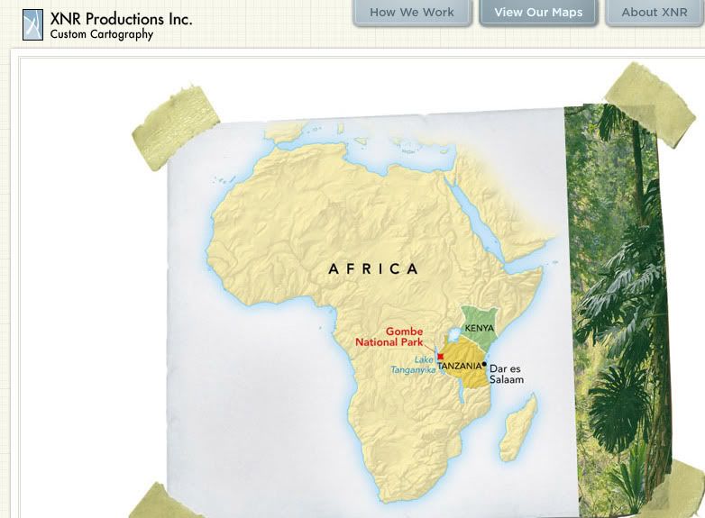
I guess sort of like this from www.xnrproductions.com
i would like realistic terrain as a soft map background texture. Thanks for any advise or links you pros can provide.
Have you looked at Fractal Terrains Pro? It's not free but a lot cheaper than professional mapping software.
nope.. but i'll look into it. But the more I learn, the more i think i need gis terrain info. like from arc explorer or something.
I heartily recommend that everyone purchase a copy of Fractal Terrains Pro (it also makes an excellent gift!)
Now that the self-serving endorsement is out of the way, I recommend looking at http://www.shadedrelief.com/ when you've got a little time to kill. Tom Patterson offers many suggestions on doing exactly the sorts of thing you describe.
And he even answers emails! Well he answered one I wrote about 6 years ago telling him how much I loved his site and how much I'd learned from it.
Sorry forgot to mention that you should check out this tutorial by HandsomeRob who uses illustrator and FT Pro to make maps of the style I think you're shooting for.
Last edited by ravells; 11-19-2009 at 07:01 PM.
Must say that FT pro is really an awesome program. I use it all the time for creating random world/continent-maps. (I even created an 8-level-deep google-maps version of a D&D world using this tool, took about 4 nights of rendering the 300K+ images. It completely configurable and supports all main projections... and its instant Gaea-, temperature-, height-maps, all ready for use. So it's well worth the money. For small overland-maps that you want to completely sculpt yourself by hand, you could use Bryce (free), which has a great sculting tool and offers 3d rendering as well. So you could create the height-map with FT and import it into Bryce or other 3d renderers like Terragen for 3d-views. Also the FT height-map can be used to render terrain-like shadows in PS using it in an alpha-channel in the render/lighting-effects filter.


Bumpmap/Lightmap type functions are fairly common in graphics software. You can do it in The GIMP for instance.
 Posting Permissions

