


 Reply With Quote
mainworking16-1408.png
Tiny update. Man, doing these mountains will take a while, but that is the price I pay for ~art~.
if i do not come back
send someone who is a specialist in wrist conditions

To make the coastline slightly less generic slash tolkienian, I'm trying out different patterns. Using the line-to-pattern or whatever it was called in Inkscape (same as the one used for the tapering river trick, except this time with Repeating (Stretched) and the original figure orthogonal to the orientation in river tapering), etc. then doing lots of selection-to-pattern-to-selection stuff in GIMP, I got this. Still a few glitches I'll fix later, but I think it looks quite ok when it's toned down with a colour instead of using heavy black.
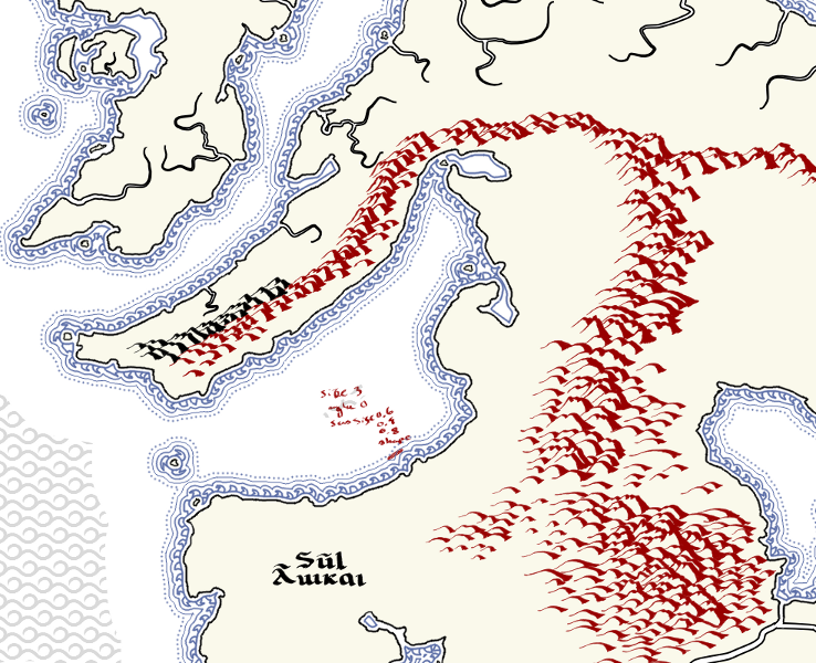
mainworking16-1408.png
Tiny update. Man, doing these mountains will take a while, but that is the price I pay for ~art~.
if i do not come back
send someone who is a specialist in wrist conditions


I hear ya. The last time I did the amount of hand-drawn mountains you're looking at, it took me months!
Gidde's just zis girl, you know?
My finished maps | My deviantART gallery
My tutorials: Textured forests in GIMP, Hand-Drawn Mapping for the Artistically Challenged
Man, months. I can't do that, I have to do now, quickly, before I lose interest and flit towards another project or passtime. The only project I've been able to really return to is my Magnum Opus Finnish Morpoglyphic writing system.Originally Posted by Gidde

Haha, well good luck and keep that momentum then
Gidde's just zis girl, you know?
My finished maps | My deviantART gallery
My tutorials: Textured forests in GIMP, Hand-Drawn Mapping for the Artistically Challenged
Naeddyr-
How is inkscape performing when you start getting that many separate items?
-Rob A>
My tutorials: Using GIMP to Create an Artistic Regional Map ~ All My Tutorials
My GIMP Scripts: Rotating Brush ~ Gradient from Image ~ Mosaic Tile Helper ~ Random Density Map ~ Subterranean Map Prettier ~ Tapered Stroke Path ~ Random Rotate Floating Layer ~ Batch Image to Pattern ~ Better Seamless Tiles ~ Tile Shuffle ~ Scale Pattern ~ Grid of Guides ~ Fractalize path ~ Label Points
My Maps: Finished Maps ~ Challenge Entries ~ My Portfolio: www.cartocopia.com
Yeah, I'm not using much Inkscape anymore, this is almost completely done in GIMP. When I did the wavy pattern (the single wave, not the subsequent lines), that was in Inkscape, and working with it, even on an empty image with only the coastline with around 2000+ nodes (simplified) was no fun. I suspect it's the paths effects application that was just super slow, and other stuff would work faster if I just left it alone, but this time I've just imported most everything right back into GIMP, where I do most of the vectory stuff I used to do in Inkscape that involve irregular shapes (like the coastline) with selections and patterns. The graticule EDIT: and rivers :EDIT are, naturally, made in inkscape (should work on that more), and small stuff like the deep ocean texture patterns, but really nothing else; I'm even doing the calligraphy in GIMP, now that I've figured out the ink tool.
Earlier yesterday, I got a really annoying Inkscape-doesn't-actually-close-but-churns-on-in-the-background-leaking-huge-amounts-of-memory when I tested out some small effect-to-path stuffs on a small test image, then closed the program and opened GIMP. The whole system became rather unresponsive (on Ubuntu 10.10), though not so unresponsive I couldn't open the system monitor tool (which took a minute or two to load) and finally pinpoint the culprit.
EDIT:
Of course, this means the map itself is not super-scalable, but it's 4500x4500 in size, and I think that might be enough for now.
Last edited by Naeddyr; 01-17-2011 at 07:06 AM.
180111previewmainm.jpg
An early demo of what style I might go for: coloured mountains denoting whether they're rain shadows (red and yellow) or wet, plus some temperature gradients. Not at all sure about the colour scheme, and this is just a preliminary test. The map has gone through my paperisation script (which can be found on my dA), but, as always, I'm unhappy with the result. Size is 50% of original working copy.
EDIT: Come to think of it, there would probably also be a lot of westerly winds, due to the desert and the ocean being so hot.
Last edited by Naeddyr; 01-17-2011 at 05:31 PM.
190111preview.jpg
Finally, the mountains are done.
Here's also a showcase of the main colouring of the mountains: red for dry and hot, brown/yellow for dry and temperate, purple/violet for dry and cold, deep green for wet and hot, a lighter yellower green for wet and temperate, and deep blue for wet and cold. EDIT: Might also make the plants follow this scheme.:TIDE
Also tried out an agening style, and I came up with a few new techniques. Still not happy with my paper texture, that most elusive of things.
Please, give comments on the colouring and aging. EDIT: Also, please opinions or tips on how to do glacier/permaice. :TIDE
Last edited by Naeddyr; 01-18-2011 at 07:36 PM.
This is really becoming its own style of map - ive never seen mountains represented like that before. Keep up the good work.
Who is John Galt?
 Posting Permissions