Reply With Quote


A tutorial on doing this with Hugin would be great!.
-Rob A>


Oh quite possibly. My own map (theoretically drawn in equirectangular/mercatory-ish) looks horrendous when slapped onto a GoogleEarth globe (as you say, all pointy and stuff). Part of me wants to go back and fix it, but another part of me says: your computer is so slow that it would take you another year of work to fix it. If there's a way to "fix" it without having to actually fix it... well... that'd save time.Originally Posted by Naeddyr

Last edited by Karro; 04-06-2009 at 11:24 AM.
I think, therefore I am a nerd.
Cogito, ergo sum nerdem.
Check out my blog: "The Undiscovered Author"
It's the story of a writer... follow me in my simple quest to get published, and share your own writing stories, adventures and writerly tips.
Pimping my worldmap here. Still WIP... long way to go, but I'm pretty proud of what I've done so far...
A tutorial on doing this with Hugin would be great!.
-Rob A>
My tutorials: Using GIMP to Create an Artistic Regional Map ~ All My Tutorials
My GIMP Scripts: Rotating Brush ~ Gradient from Image ~ Mosaic Tile Helper ~ Random Density Map ~ Subterranean Map Prettier ~ Tapered Stroke Path ~ Random Rotate Floating Layer ~ Batch Image to Pattern ~ Better Seamless Tiles ~ Tile Shuffle ~ Scale Pattern ~ Grid of Guides ~ Fractalize path ~ Label Points
My Maps: Finished Maps ~ Challenge Entries ~ My Portfolio: www.cartocopia.com
It's basically this, I'll elaborate later
Take your equirectangular map into Hugin (as per my other tutorial)
You don't really have to do anything but rotate the image ninety degrees (using the last numerical option in Numerical Transformations thingie in the preview), like so:
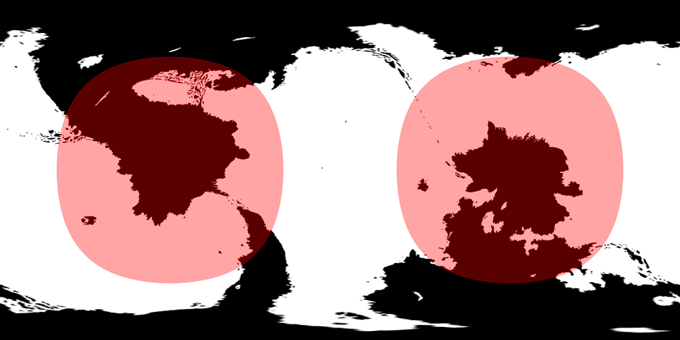
Output this, and you have a map of your poles, in Equirectangular. Do your magic on it, then do this whole thing again in reverse, and rotate the image -90 degrees to get the map in the correct alignment, again. there's some distortion, so you might just want to combine the equatorial regions of the original map with the polar regions of the your new map in GIMP, which should give you the best of both worlds. I usually do my cartographical transformations using high-contrast images that I then use as basis of new pictures (drawing over them or tracing them in a vector program), so this isn't the best way to draw stuff on the actual poles except for stuff like landmasses and other thick stuff that can survive the transformation.
Last edited by Naeddyr; 04-06-2009 at 11:56 AM.
This is incredible insanely cool!
I'd wanted to do this for a while and never knew I already had the tool for it!!!!
You can use hugin to remap an equirectangular projection to ANY spot just by typing int he lat and long! Brilliant for generating local maps from world maps and correcting for much of the distortion!
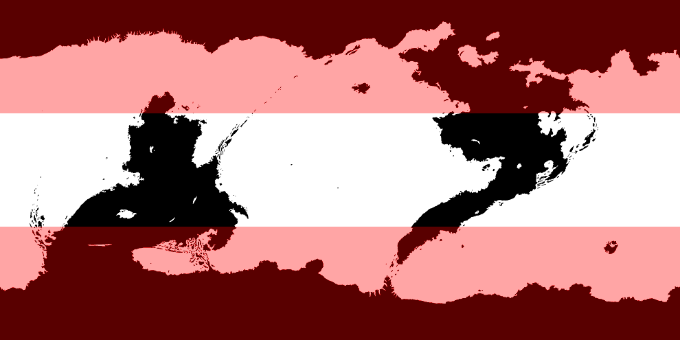
For example, here is the world centered on Niagara Falls:
And the settings (note these are just sign offset lat and longs for the location!)
And one more for the CWBP guys:
-Rob A>
My GIMP Scripts: Rotating Brush ~ Gradient from Image ~ Mosaic Tile Helper ~ Random Density Map ~ Subterranean Map Prettier ~ Tapered Stroke Path ~ Random Rotate Floating Layer ~ Batch Image to Pattern ~ Better Seamless Tiles ~ Tile Shuffle ~ Scale Pattern ~ Grid of Guides ~ Fractalize path ~ Label Points
My Maps: Finished Maps ~ Challenge Entries ~ My Portfolio: www.cartocopia.com
Anyhow, some WIP here.
There's a couple of rendering mistakes on the output image, artefacts from Inkscape that can't be helped except through magic. I had the same kind of rendering glitch with another thing. Really weird. If I duplicate the affected items and moved them around, they'd be affected in the different areas (the same "area" on the screen, different relative to the objects), like there was some sort of shape that was clipping away the fill (and only fill) from them at that point, and only for certain objects... If I flipped the whole thing horizontally (it was symmetrical), there was no glitch. Here, the glitch is that one of the coastal dithering lines (number one or two) is missing from part of the upper continent's southern sea coast. Weird stuff.
Here's some test mountains and hills. Trying to figure out how to simulate extreme height and plateaus and connected height, etc.
Looks good, I like the mountains.
Also... the Hugin used in your little example above, this is the same Hugin that is used to stitch panoramas?
Last edited by Karro; 04-07-2009 at 10:22 AM.
I think, therefore I am a nerd.
Cogito, ergo sum nerdem.
Check out my blog: "The Undiscovered Author"
It's the story of a writer... follow me in my simple quest to get published, and share your own writing stories, adventures and writerly tips.
Pimping my worldmap here. Still WIP... long way to go, but I'm pretty proud of what I've done so far...
The very same.
EDIT:
argh i can't get it right
I WILL CREATE THE PERFECT MOUNTAINS IF IT KILLS SOMEONE ELSE THAN ME
just you see!!
Last edited by Naeddyr; 04-07-2009 at 04:53 PM.
AAGHHH!! Look what your ceaseless quest for perfect mountains has done...
Come...closer...*cough*
The mountains...look...fine..I really like...the test ones...bleaaaagghhhh........
That's because the test one's didn't have any horizontally aligned chains! I'd really like to have a style that is consistent for all chains (older mountains can have the brush method), and I even kept on thinking about this in bed so's a coold nae sleep.
 Posting Permissions