As asked, ive produced a small tutorial explaining how to create 3d stsr maps like the one i used in a map i made:


As asked, ive produced a small tutorial explaining how to create 3d stsr maps like the one i used in a map i made:
That's cool.
You know what would be awesome, if you had a table of distances between each star. Unless you have teleportation (in which case they probably don't care about a 3D map anyway), then travel distance is a factor even for FTL.
It'd be even awesomer if you could represent those distances between the star points themselves, even better than a separate table. But it'd get cluttered quick, huh. Maybe just the major routes?
Venus Public Transit, Map Of Ceres, Jack Vance's Ports Of Call & Lurulu ... why do I only have 3 maps here?
Well thats fairly easy to do, i can sow how to do it, but its just using pytagoras if you know the distance to the star you want in X and the height from x for y.
A table would be the best option IMHO, otherwise theyd be too many lines (specially if its a large map), though you could provide the y distance and the x distance to reference next to each star plus the equation in the map key.
Last edited by zhar2; 07-09-2009 at 02:09 PM.
Does anybody have the formula handy for Δx Δy Δz?
Venus Public Transit, Map Of Ceres, Jack Vance's Ports Of Call & Lurulu ... why do I only have 3 maps here?
you mean x2-x1, y2-y1, z2-z1?
Distance in 3D works the same as in 2D, you just tack the Z in on the end of Pythagorean to get the distance. Rather than Sqrt( (dX)^2 + (dY)^2) you get Sqrt( (dX)^2 + (dY)^2 (dZ)^2)
Cool. So write a star database in Flash and have it place all the points like zhar2 did in his tute, and then draw distance-labelled routes. w00t!
... edit ... sorry, I was in coding mode ... I get coding & cartography confused sometimes ...
Last edited by töff; 07-09-2009 at 02:45 PM.
Venus Public Transit, Map Of Ceres, Jack Vance's Ports Of Call & Lurulu ... why do I only have 3 maps here?
Well something in doce for flash is a bit beyond me lol.
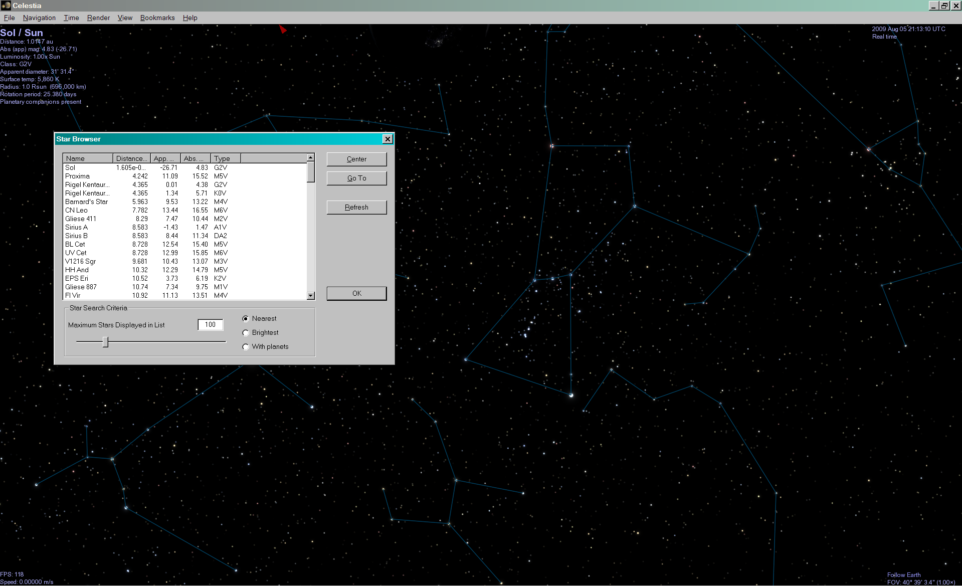
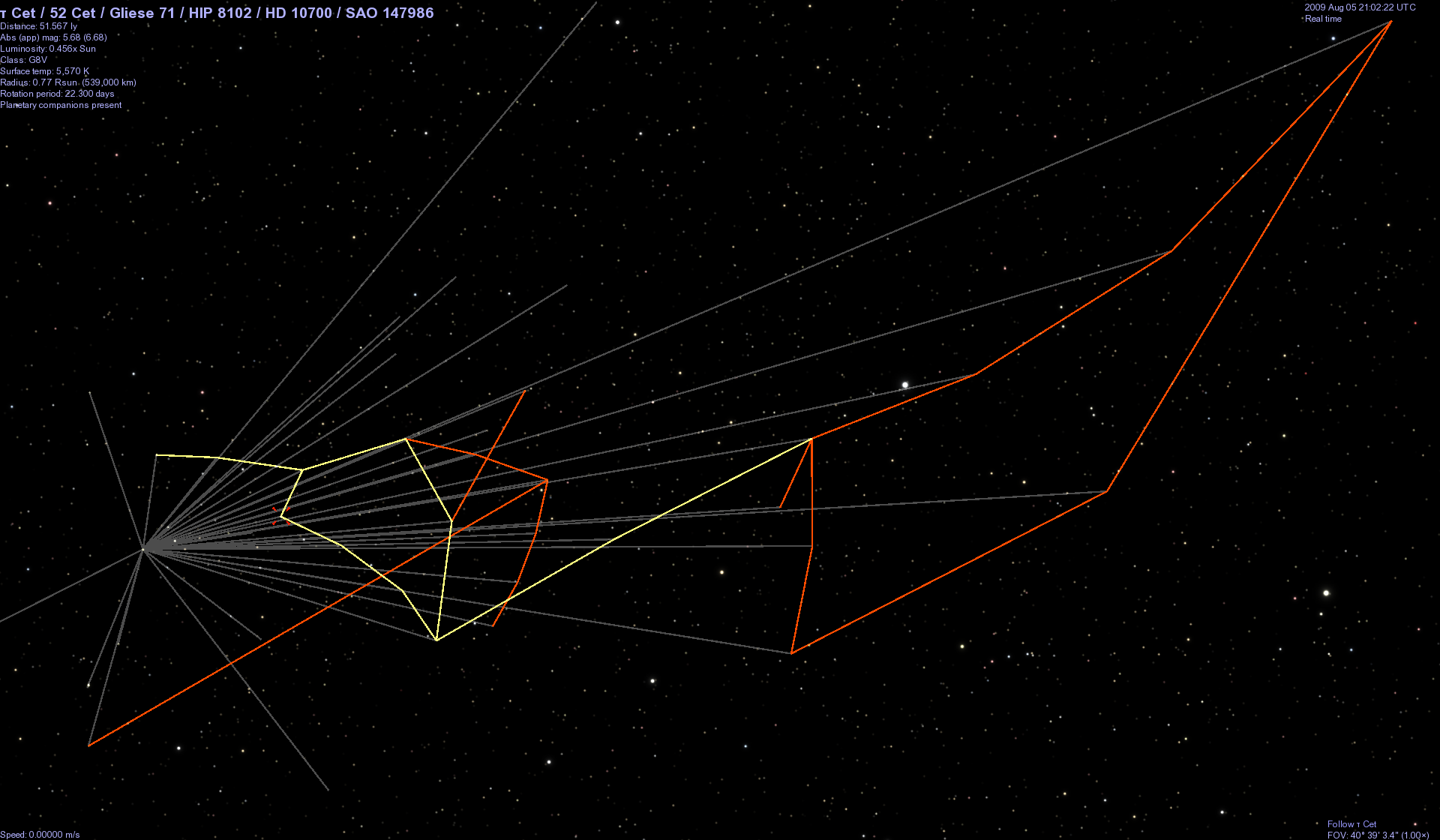
Are you folks aware of Celestia?
It's a free 3D astronomy program which includes a database of about 100,000 nearby stars.
http://www.shatters.net/celestia/
When your viewpoint is at one star, one of its menus shows the distances to other stars.
It can draw lines between stars (in 3D), either by (mis)using its constellation file (shown above) or by creating an appropriate model, as I did to show the traderoutes of C.J.Cherryh's Alliance-Union stories.
[edit]
But of course, Zhar2 knows all about Celestia
[/edit]
Last edited by selden; 08-05-2009 at 05:19 PM.
 Posting Permissions

 Reply With Quote